Photos • Location
| Ubari Landscape Conservation Area | |
|---|---|
 | |
| Location | Estonia |
| Coordinates | 59°29′30″N 25°17′30″E / 59.4917°N 25.2917°E |
| Area | 59 ha |
| Established | 2005 |
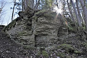
Ubari Landscape Conservation Area is a nature park which is located in Harju County, Estonia. [1]
The area of the nature park is 59 ha. [2]
The protected area was founded in 2005 to protect North Estonia Klint and broadleaved forest communities in Jõelähtme Parish ( Kaberneeme and Haapse village). [1]
- ^ a b "Ubari maastikukaitseala kaitse alla võtmine ja kaitse-eeskiri – Riigi Teataja". www.riigiteataja.ee. Retrieved 1 April 2021.
- ^ "Protected Planet | Ubari Maastikukaitseala". Protected Planet. Retrieved 1 April 2021.
