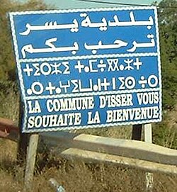
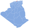
Photos • Location
36°42′58″N 3°39′58″E / 36.716°N 3.666°E
Isser | |
|---|---|
Commune and town | |
 | |
| Country | |
| Province | Boumerdès Province |
| Population (1998) | |
| • Total | 27,990 |
| Time zone | UTC+1 ( CET) |
Isser, formerly spelled Issers ( Arabic: يسر, Kabyle: ⵉⵙⴻⵔ) is a town and commune in Boumerdès Province, Algeria. According to the 1998 census it has a population of 27,990. [1] As of the latest census it has 32,580 residents. [2]
Isser is located on the south bank of the Isser River and near the centre of the Isser coastal plain, which stretches from Thenia to Naciria.
History
French conquest
- First Battle of the Issers (1837)
Algerian Revolution
Salafist terrorism
- 2008 Issers bombing (19 August 2008)
Transport
The road RN 12 runs through Isser, linking it with Si-Mustapha to the west and Bordj Menaïel to the east. The smaller RN 68 links it to Djinet in the north and Chabet el Ameur in the south. [3]
Zawiya
Notable people
- Sidi Abder Rahman El Thaelebi, Algerian Islamic scholar
- Messaoud Aït Abderrahmane, Algerian footballer
- Raïs Hamidou, Algerian privateer
References
- ^ Statoids
- ^ " ﺗﻮزﻳﻊ اﻟﺴﻜﺎن اﻟﻤﻘﻴﻤﻴﻦ ﻣﻦ اﻷﺳﺮ اﻟﻌﺎدﻳﺔ واﻟﺠﻤﺎﻋﻴﺔ ﺣﺴﺐ ﺑﻠﺪﻳﺔاﻹﻗﺎﻣﺔ واﻟﺘﺸﺘﺖ / Répartition de la population résidente des ménages ordinaires et collectifs, selon la commune de résidence et la dispersion." ( Archive) National Office of Statistics. Retrieved on 13 March 2013.
- ^ "Atlas Routier de l'Algérie : Wilaya de Boumerdès". Archived from the original on 2019-03-15. Retrieved 2019-01-08.
