Photos • Location

Titouna | |
|---|---|
| Motto: تيتونة | |
| Coordinates: 36°42′27″N 3°35′34″E / 36.7076255°N 3.5928705°E | |
| Commune | Souk El-Had |
| District | Thénia District |
| Province | Boumerdès Province |
| Region | Kabylie |
| Country | |
| Area | |
| • Total | 2 km2 (0.8 sq mi) |
| Dimensions | |
| • Length | 2 km (1 mi) |
| • Width | 1 km (0.6 mi) |
| Elevation | 140 m (460 ft) |
| Time zone | UTC+01:00 |
| Area code | 35020 |
Titouna is a village in the Boumerdès Province in Kabylie, Algeria. [1] [2]
Location
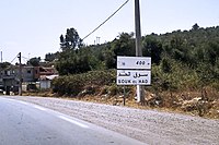
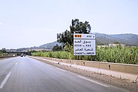
The village is surrounded by Isser River and the towns of Souk El-Had, Thénia and Beni Amrane in the Khachna mountain range. [3] [4] [5]
Buildings
Notable people
Gallery
-
 Titouna
 -
 Titouna
 -
 Road of Titouna
 -
 Road of Titouna
 -
 Road of Titouna


References
- ^ "اكتشاف مواقع أثرية هامة في بومرداس". جزايرس.
- ^ "نحو تحويل معتقل التعذيب "حوش قوتي" ببلدية سوق الحد إلى معلم تذكاري". جزايرس.
- ^ معتقل "حوش قوتي" بسوق الحد (بومرداس ) : شاهد على انتهاك المحتل لأدمية الإنسان
- ^ "مديرية المجاهدين تشرع في تصوير مركز التعذيب "حوش قوتي" بسوق الحد". جزايرس.
- ^ ""Le camp de torture Haouch Goutier, témoin des atrocités de l'occupant"". Djazairess.
| A | |
|---|---|
| B | |
| C | |
| D | |
| E | |
| F | |
| G | |
| H | |
| L | |
| M | |
| O | |
| S | |
| T | |
| Z | |
|
| This article about a location in Boumerdès Province is a stub. You can help Wikipedia by expanding it. |