Photos • Location

| Site of Special Scientific Interest | |
 | |
| Location | Kent |
|---|---|
| Grid reference | TR 125 476 [1] |
| Interest | Biological |
| Area | 25.4 hectares (63 acres) [1] |
| Notification | 1985 [1] |
| Location map | Magic Map |
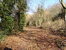
Yockletts Bank is a 25.4-hectare (63-acre) biological Site of Special Scientific Interest west of Stelling Minnis in Kent. [1] [2] It is managed by KWT [3] and is part of Kent Downs Area of Outstanding Natural Beauty. [3]
This sloping site has woodland on dry chalk soils. There are diverse woodland breeding birds, and the ground flora is dominated by bluebells, but there are also many orchids. [4]
There is access from the road called Gogway, which runs through the site.
References
- ^ a b c d "Designated Sites View: Yockletts Bank". Sites of Special Scientific Interest. Natural England. Retrieved 25 February 2018.
- ^ "Map of Yockletts Bank". Sites of Special Scientific Interest. Natural England. Retrieved 25 February 2018.
- ^ a b "Yockletts Bank". Kent Wildlife Trust. Archived from the original on 3 January 2018. Retrieved 26 January 2018.
- ^ "Yockletts Bank citation" (PDF). Sites of Special Scientific Interest. Natural England. Retrieved 25 February 2018.
Wikimedia Commons has media related to
Yockletts Bank.