Photos • Location
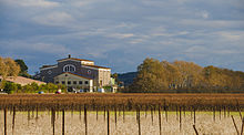
The winemaking cooperative.


Thézan-lès-Béziers | |
|---|---|
 The
Montagne Noire and part of the commune of Thézan-lès-Béziers | |
.svg) Coat of arms | |
 Thézan-lès-Béziers  Thézan-lès-Béziers | |
| Coordinates: 43°25′21″N 3°10′14″E / 43.4225°N 3.1706°E | |
| Country | France |
| Region | Occitania |
| Department | Hérault |
| Arrondissement | Béziers |
| Canton | Cazouls-lès-Béziers |
| Intercommunality | CC Les Avant-Monts |
| Government | |
| • Mayor (2020–2026) | Alain Duro [1] |
| Area 1 | 13.65 km2 (5.27 sq mi) |
| Population (2021)
[2] | 3,062 |
| • Density | 220/km2 (580/sq mi) |
| Time zone | UTC+01:00 ( CET) |
| • Summer ( DST) | UTC+02:00 ( CEST) |
| INSEE/Postal code |
34310 /34490 |
| Elevation | 15–132 m (49–433 ft) (avg. 63 m or 207 ft) |
| 1 French Land Register data, which excludes lakes, ponds, glaciers > 1 km2 (0.386 sq mi or 247 acres) and river estuaries. | |
Thézan-lès-Béziers (French pronunciation: [tezɑ̃ lɛ bezje], Thézan near Béziers; Languedocien: Tesan de Besièrs) is a commune in the Hérault department in the Occitanie region in southern France.
Population
| Year | Pop. | ±% p.a. |
|---|---|---|
| 1968 | 1,499 | — |
| 1975 | 1,957 | +3.88% |
| 1982 | 2,016 | +0.43% |
| 1990 | 2,008 | −0.05% |
| 1999 | 2,077 | +0.38% |
| 2007 | 2,484 | +2.26% |
| 2012 | 2,776 | +2.25% |
| 2017 | 2,987 | +1.48% |
| Source: INSEE [3] | ||

See also
References
- ^ "Répertoire national des élus: les maires". data.gouv.fr, Plateforme ouverte des données publiques françaises (in French). 2 December 2020.
- ^ "Populations légales 2021". The National Institute of Statistics and Economic Studies. 28 December 2023.
- ^ Population en historique depuis 1968, INSEE
Wikimedia Commons has media related to
Thézan-lès-Béziers.
| Authority control databases: National |
|---|
|
| This Hérault geographical article is a stub. You can help Wikipedia by expanding it. |