| Lithuania-Poland border | |
|---|---|
 Border sign in Poland | |
| Characteristics | |
| Entities | |
| Length | 104 kilometres (65 mi) |
| History | |
| Established | 1922 1945 |
| Current shape | 6 September 1991 |
| Treaties | Suwałki Agreement (1920) |

The LithuaniaŌĆōPoland border is the state border between the Republic of Lithuania and the Republic of Poland. The length of the border is 104 kilometres (65 mi). [1] [2] It runs from the LithuaniaŌĆōPolandŌĆōRussia tripoint southeast to the BelarusŌĆōLithuaniaŌĆōPoland tripoint. It is an internal border of the European Union and the Schengen Zone.
It is the only land border that one of the Baltic states (which are members of the EU and NATO) shares with a country that is not a member of the Commonwealth of Independent States. [3]
History
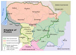
In medieval times, the Kingdom of Poland and the Grand Duchy of Lithuania had a vast and often changing border. [4] From the Union of Lublin (1569) to the Partitions of Poland, there was no Polish-Lithuanian border, as both countries were a part of a single federated entity, the PolishŌĆōLithuanian Commonwealth. [5] During the partitions of Poland era, there were borders between the Congress Poland ( August├│w Voivodeship) and territory seized by the Russian Empire ( Kovno Governorate and Vilna Governorate). A different border existed between the Second Polish Republic and Lithuania in the period of 1918ŌĆō1939. Following the PolishŌĆōLithuanian War, from 1922 onward it was stable and had a length of 521 km. [6] [7] Suwa┼éki Agreement (1920) established the demarcation line through the Suwa┼éki Region and for the most part it remains the border between Poland and Lithuania in modern times. [8] [9] The current border was established in the aftermath of World War II.
In the Suwa┼éki County the settlement of Mejszeszki, located north-west of the town of Wi┼╝ajny, was incorporated into Poland. To the north-east of Wi┼╝ajny, near the village of Laskowskie, the Lithuanian settlement of Auksztokalnia reached Poland. The border ran the same as in 1939. The area of the commune was inhabited by Lithuanian people. In the Kadaryszki commune, Poland was allocated 4 hectares of land, and changes to the border zone were minimal. Then the border ran through the Zaboryszki commune. In its area, in the town of Trampole, one farm was transferred to Poland. In the Serwy commune, near the village of Wo┼éy┼äce, 3 pieces of land with an area of 0.5 ha were transferred from Poland to Lithuania. On Ga┼éadu┼ø Lake an island left Poland, in the Giby Commune the following settlements handed over from Poland to the Lithuanian SSR: Kalety, Studzianka, Kodzie, Wolka Rz─Ödowa, Rynkowie, D─ģbrowka, Czortek. The border was demarcated without considering elementary economic principles. It resulted in the separation of most agricultural land from habitats and, in some cases, divided habitats. It was planned to create a security belt within a radius of 20 km from the border, from which all national minorities would be removed and repopulated with repatriates. This was intended to prevent the Belarusian population from crossing the border illegally. A similar conclusion was made in the Sok├│┼éka County. In August├│w County, the population supported border changes. In Suwa┼éki County, the District Plenipotentiary for delimitation stated that Lithuanians living in the areas which were annexed to Poland were hostile to the authorities and should be removed abroad. [10]
In August 1948, the TASS agency announced a communication on the completion of delimitation of the border. However, the local authorities determined the final shape of the border and belonging of individual villages or their fragments for more than a year and a half. The border since runs along the Marycha River and the current Polish-Lithuanian border, from the point on Marycha, 2 kilometers below the site, to the point where the territories of the Polish and Lithuanian SSR and the area of former East Prussia near the hamlet of Gromadczyzna meet (54.36081715,22.79983067), over a distance of approximately 102 kilometers from a deviation from the previously mentioned border at the village of Grau┼╝yny to the north and at the town of Misiszki to the south and a few minor straightening (border posts no. 1789 to 1987), leaving on the Polish side the following settlements: Pozasko, Budwiec, Markiszki, Ho┼éyny, Rachelany, Burbiszki, Borys├│wka, Polu┼äce, Ber┼╝niki, Wo┼éy┼äce, Krejwiany, Trompoliszki, Wojciuliszki, Jegliniec, Budzisko, Majdan, Kopowo, Smolnica, Poszeszupie, Butowszczyzna, Krejwiany, Ejszeryszki, Wilkupie, Olszanka Stakuny, Burniszki, Grzybina and Gromadczyna and an island on Lake Ga┼édau┼ø. The following settlements remained on the Lithuanian (then part of the Soviet Union) side: [10] Helenowo, Ustronie, Podbuwie─ć, Subacze, Kuciony, Okmiany, Kalwiszki, Tarn├│wka, Barwisze, U┼║dzienniki, Grali┼äce, Biela┼äce, Kibarty, Polance, Buraki, Olkszniany, Gi┼éujsze, Trompole, Zegaryszki, Grungliszki, Durpiej, Czarna Buda, Wo┼ékowizna, Kamionka, Rykosieje, Lubowo, Nowosady, Barwisze, Wartele, Auksztokalne, Ogliniszki, Poszyrwinty, Misiszki and Okszyszki and two islands on Lake Ga┼éadu┼ø. The border crossed the settlement of Grau┼╝yny and a number of lakes, in particular Lake Walenicze, Ga┼éadu┼ø, Grau┼╝yny (54.3916637 22.9444432) Durajewo and Olgiel up to the tri-point border between Poland, Lithuania and Russia ( Kaliningrad Oblast) at 54.3633455, 22.79200182.
The border has since remained identical during the Soviet occupation of the Baltic states as well as after the restoration of the independence of Lithuania on 11 March 1990. [11] [12] [13] On 5 March 1996, both countries signed a treaty on the common border, confirming its status and demarcation, as well as agreeing on the technical cooperation. [14]
Lithuania and Poland joined the Schengen Area in 2007. This meant that all border checkpoints were removed along the border in December 2007, allowing unrestricted border crossing.
On 26 February 2023 Lithuanian customs reinstated third party cargo check points at the LithuaniaŌĆōPoland border, due increased cargo freight from non-EU countries via Poland and Lithuania to Belarus. [15] [16]
Military significance

To the military planners of NATO, the border area is known as the Suwałki Gap (named after the nearby town of Suwałki) because it represents a military difficulty. It is a flat narrow piece of land, a gap, that is between Belarus and Russia's Kaliningrad exclave and that connects the three NATO-member Baltic States to Poland and the rest of NATO. [17] In the event of a Russian attack, the Suwałki Gap would for Russia be important both for connecting Kaliningrad to the rest of Russia, and to prevent military assistance from the other NATO countries to reach the Baltic countries.
In July 2016, two years after the annexation of Crimea by the Russian Federation and the beginning of the War in Donbass, NATO's member states agreed at the 2016 Warsaw summit to what would become known as the NATO Enhanced Forward Presence. [18] [19] [20]
A July 2017 NATO exercise was for the first time focused on defense of the gap from a possible Russian attack, [18] and used troops and materiel from US, British, Polish, Lithuanian and Croatian sources. [19]
In September 2017, Russia and Belarus produced the Zapad 2017 exercise.
Former border crossings

In the period 1991ŌĆō2007, there were three road and one rail border crossing between Poland and Lithuania. [21]
On 1 May 2004, when both Poland and Lithuania joined the European Union, this border became an internal border of the European Union. [22] On 21 December 2007, Poland and Lithuania acceded to the Schengen Agreement. [23] After this, crossing the border became easier, as EU internal borders are open to all traffic with little need for control. There are still, however, occasional customs and police controls against smuggling of restricted goods; these affect only about 1% of travelers. [24] [25] [26]
Road
Rail
Gallery
-
 Map of Poland from the early 11th century shows Polish and Lithuanian lands separated by Old Prussian and Kievan Rus' territories
 -
 Map of Poland in the first half of the 13th century, shows a border between Duchy of Masovia and Lithuania
 -
 Map of Poland and Lithuania around 1275ŌĆō1300, with visible PolishŌĆōLithuanian border
 -
 Map of Poland and Lithuania around 1333ŌĆō1370, with visible PolishŌĆōLithuanian border
 -
 Map of Poland and Lithuania around 1370ŌĆō1382, with visible PolishŌĆōLithuanian border
 -
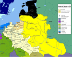
 Map of Poland and Lithuania around 1386ŌĆō1434, with visible PolishŌĆōLithuanian border
 -
 Map of Poland and Lithuania around 1466, with visible PolishŌĆōLithuanian border
 -
 Map of Poland and Lithuania around 1526, with visible PolishŌĆōLithuanian border
 -
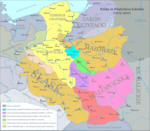
 Map of Polish-Lithuania Commonwealth after its formation in 1569, with visible PolishŌĆōLithuanian border. Ukrainian territories were transferred under the administrative control of the Crown of Poland.
 -
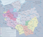
 Map of Lithuania around 1867ŌĆō1914, with visible PolishŌĆōRussian border (Lithuania did not exist at that time)
 -
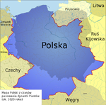
 Selected lines of demarcation between Lithuania and Poland, 1919ŌĆō1939. Light orange line denotes the line drawn by the Suwa┼éki Agreement.

.png)
.png)


_and_the_Crown_of_the_Kingdom_of_Poland_(red)_in_1386_-_1434.png)


References
-
^ "Warunki Naturalne I Ochrona Środowiska" [Environment and Environmental Protection].
Ma┼éy Rocznik Statystyczny Polski 2013 [Concise Statistical Yearbook of Poland 2013] (in Polish and English). G┼é├│wny Urz─ģd Statystyczny. 2013. p. 26.
ISSN
1640-3630.
{{ cite book}}:|journal=ignored ( help) - ^ "Prezydent RP - Informacje o Polsce" (in Polish). Archived from the original on 25 June 2009. Retrieved 17 March 2015.. Page gives Polish PWN Encyklopedia as reference.
- ^ Vladimir Shlapentokh (1 January 2001). The Legacy of History in Russia and the New States of Eurasia. M.E. Sharpe. p. 100. ISBN 978-0-7656-1398-1.
- ^ Stephen R. Burant and Voytek Zubek, Eastern Europe's Old Memories and New Realities: Resurrecting the PolishŌĆōLithuanian Union, East European Politics and Societies 1993; 7; 370, online
- ^ Halina Lerski (19 January 1996). Historical Dictionary of Poland, 966ŌĆō1945. ABC-CLIO. p. 308. ISBN 978-0-313-03456-5.
- ^ Polska w cyfrach[ permanent dead link] [in:] E. Romer Atlas Polski współczesnej, 1928[ permanent dead link].
- ^ Michael Brecher (1997). A Study of Crisis. University of Michigan Press. pp. 252ŌĆō255. ISBN 0-472-10806-9.
- ^ ┼üossowski, Piotr (1995). Konflikt polsko-litewski 1918ŌĆō1920 (in Polish). Warsaw: Ksi─ģ┼╝ka i Wiedza. pp. 166ŌĆō175. ISBN 83-05-12769-9.
- ^ Tadeusz Radziwonowicz. "Policja w ochronie granicy na odcinku suwalskim" (PDF) (in Polish).
- ^ a b Marek Kietliński (2002). "Delimitacja polskiej granicy wschodniej 1944-1950" (PDF). Zeszyt Naukowy Muzeum Wojska. Bialystok.
- ^ Peter Andreas; Timothy Snyder (1 January 2000). The Wall Around the West: State Borders and Immigration Controls in North America and Europe. Rowman & Littlefield. p. 187. ISBN 978-0-7425-0178-2.
- ^ Yaël Ronen (19 May 2011). Transition from Illegal Regimes under International Law. Cambridge University Press. p. 138. ISBN 978-1-139-49617-9.
- ^ "LR AT AKTO D─Śl Lietuvos nepriklausomos valstyb─Śs atstatymo signatarai". Lietuvos Respublikos Seimas.
- ^ "Lietuvos Respublikos ir Lenkijos Respublikos sutartis d─Śl bendros valstyb─Śs sienos, su ja susijusi┼│ teisini┼│ santyki┼│, taip pat d─Śl bendradarbiavimo ir abipus─Śs pagalbos ┼Īioje srityje" [Treaty between the Republic of Lithuania and the Republic of Poland on the common state border, legal relations connected therewith, and on the cooperation and mutual assistance in this field]. Office of the Seimas of the Republic of Lithuania (in Lithuanian). 5 March 1996. Retrieved 9 August 2021.
- ^ Pareig┼½nai pradeda krovininio transporto kelion─Śs leidim┼│ tikrinim─ģ pasienyje su Lenkija
- ^ Pasienyje su Lenkija patikrinta 110 tre─Źi┼│j┼│ ┼Īali┼│ vilkik┼│: daliai j┼│ teko gr─»┼Šti atgal
- ^ Bearak, Max (20 June 2016). "This tiny stretch of countryside is all that separates Baltic states from Russian envelopment". The Washington Post. Retrieved 20 June 2016.
- ^ a b Sytas, Andrius (18 June 2017). "NATO war game defends Baltic weak spot for first time". Reuters. Retrieved 18 June 2017.
- ^ a b "NATO war game defends Baltic weak spot for first time". EURACTIV MEDIA NETWORK BV. 19 June 2017.
- ^ "Closing the Gap: NATO Moves to Protect Weak Link in Defenses Against Russia". WSJ. Dow Jones & Company, Inc. 17 June 2016.
- ^ Kancelaria Sejmu RP. "Internetowy System Akt├│w Prawnych". sejm.gov.pl.
- ^ Stephen Kabera Karanja (January 2008). Transparency and Proportionality in the Schengen Information System and Border Control Co-Operation. Martinus Nijhoff Publishers. p. 39. ISBN 978-90-04-16223-5.
- ^ "Europe's border-free zone expands". BBC News. 27 December 2007. Retrieved 11 April 2015.
- ^ "Nowe polsko-litewskie drogi po wej┼øciu do Schengen". DELFI. 28 July 2012.
- ^ "Wspólne patrole na polsko-litewskiej granicy :: społeczeństwo". Kresy.pl.
- ^ "Przemyt papieros├│w przy polsko ŌĆō litewskiej granicy [ZDJ─śCIA]". bialystok. 16 May 2014.
External links
- "LithuaniaŌĆōPoland cross-border cooperation programme, a EU programme". Archived from the original on 18 July 2008.
- "Suwalki Gap". GlobalSecurity.org.
- "Securing The Suwałki Corridor: Strategy, Statecraft, Deterrence, and Defense". 9 July 2018.
- "This tiny stretch of countryside is all that separates Baltic states from Russian envelopment". The Washington Post.