Photos • Location
(Redirected from
Hớn Quản District)
Hớn Quản
Huyện Hớn Quản | |
|---|---|
 | |
|
| |
| Country | |
| Region | Southeast |
| Province | Bình Phước |
| Capital | Tân Khai |
| Area | |
| • Total | 256.3 sq mi (663.8 km2) |
| Population (2018) | |
| • Total | 115,268 |
| • Density | 450/sq mi (170/km2) |
| Time zone | UTC+7 (UTC + 7) |
| Website | Official Website |
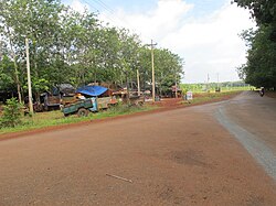
Hớn Quản is a district in Bình Phước province. It was founded on August 11, 2009 from part of Bình Long. It has area of 663.8 km2.
The district is subdivided to 13 commune-level subdivisions, including Tân Khai township (district capital) and the rural communes of: Thanh An, An Khương, Đồng Nơ, Tân Hiệp, Minh Đức, Minh Tâm, Tân Lợi, Phước An, Tân Hưng, Thanh Bình, An Phú and Tân Quan. [1]
References
11°37′37″N 106°36′02″E / 11.62694°N 106.60056°E

