Photos • Location

The Fiherenana delta
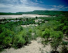
Fiherenana River

| Fiherenana River | |
|---|---|
 Rivers of Madagascar | |
| Location | |
| Country | Madagascar |
| Region | Atsimo-Andrefana |
| Cities | Beantsy, Tulear |
| Physical characteristics | |
| Mouth | Indian Ocean |
• location | Belalanda, near Tulear, Atsimo-Andrefana |
• coordinates | 23°18′35″S 43°37′50″E / 23.30972°S 43.63056°E |
• elevation | 0 m (0 ft) |
| Basin size | 7,500 km2 (2,900 sq mi) to 7,740.8 km2 (2,988.7 sq mi) [1] |
| Discharge | |
| • location | Near mouth |
| • average | (Period: 1971–2000)16.9 m3/s (600 cu ft/s) [1] |
| Discharge | |
| • location | Mahaboboka |
| • average | 35.4 m3/s (1,250 cu ft/s) |
| Basin features | |
| River system | Fiherenana River |

Fiherenana is a river in the region Atsimo-Andrefana in southern Madagascar. It flows into the Indian Ocean at Tulear.

Due to a local fady (taboo), pirogues are not allowed on this river. [2]
References
- ^ a b "Madagascar".
- ^ (in French) La vallée du Fiherenana (Toliara)