Photos • Location


Anjozorobe | |
|---|---|
Town | |
 | |
 Anjozorobe | |
| Coordinates: 18°24′12″S 47°51′00″E / 18.40333°S 47.85000°E | |
| Country | |
| Region | Analamanga |
| District | Anjozorobe |
| Area | |
| • Total | 512 km2 (198 sq mi) |
| Elevation | 1,270 m (4,170 ft) |
| Population 2018 | |
| • Total | 24,117 |
| Time zone | UTC+3 ( EAT) |
| postal code | 105 |
Anjozorobe is a large town in the Analamanga Region, Madagascar, approximately 90 kilometers north-east of the capital Antananarivo. It has a population of 24,117 inhabitants in 2018.
Anjozorobe-Angavo Reserve is one of the last high plateau forest in Madagascar. Another high plateau forest is located in the protected area of Ambohitantely.
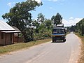
The town is linked with Antananarivo by the National Road 3.
The Mananara, an affluet on the Betsiboka River, flows near this municipality.
The Anjozorobe-Angavo Reserve is situated approximately 11 km East of the town.
-
 Church of Anjozorobe
 -
 College
 -
-
 Town hall
 -
 Post office
 -
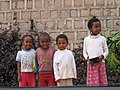 and its people


Wikimedia Commons has media related to
Anjozorobe.
Capital:
Antananarivo | ||
| Ambohidratrimo (24) - 105 |  | |
| Andramasina (14) - 106 | ||
| Anjozorobe (18) - 107 | ||
| Ankazobe (15) - 108 | ||
| Antananarivo-Atsimondrano (26) - 102 |
| |
| Antananarivo-Avaradrano (16) - 103 | ||
| Antananarivo-Renivohitra (1) - 101 | ||
| Manjakandriana (23) - 116 | ||
8 districts; 137 communes | ||
|
| This Analamanga location article is a stub. You can help Wikipedia by expanding it. |