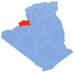
Photos • Location
Zoubia | |
|---|---|
Commune | |
| Coordinates: 32°8′42″N 0°59′57″W / 32.14500°N 0.99917°W | |
| Country | |
| Province | Béchar Province |
| District | Béni Ounif District |
| Commune | Béni Ounif [1] |
| Elevation | 869 m (2,851 ft) |
| Time zone | UTC+1 ( CET) |
Zoubia is a village in south-western Algeria. [2] It is part of the commune of Béni Ounif, [1] in Béchar Province, Algeria, and is 25 kilometres (16 mi) northeast of the town of Béni Ounif.
References
- ^ a b "Décret n° 84-365, fixant la composition, la consistance et les limites territoriale des communes. Wilaya d'El Oued" (PDF) (in French). Journal officiel de la République Algérienne. 19 December 1984. p. 1489. Archived from the original (PDF) on 12 January 2012. Retrieved 2 March 2013.
- ^ "Zoubia, Algeria". Google Maps. Retrieved 11 March 2013.
Neighbouring towns and cities

