Photos • Location
Slovakia zahradne 5.jpg

Location of
Prešov District in the
Prešov Region.


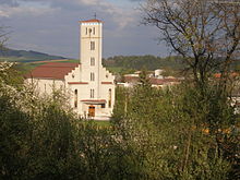
Záhradné ( Hungarian: Szedikert) is a village and municipality in Prešov District in the Prešov Region of eastern Slovakia.
History
In historical records the village was first mentioned in 1285.
Geography
The municipality lies at an altitude of 322 metres and covers an area of 8.77 km2 (3.39 sq mi) (2020-06-30/-07-01). [1]
References
- ^ "Statistic of Slovak places by Dušan Kreheľ – Export". Retrieved 2021-07-05.
External links
49°05′N 21°16′E / 49.083°N 21.267°E
|
| This Prešov Region geography article is a stub. You can help Wikipedia by expanding it. |