Photos • Location

Wola Filipowska | |
|---|---|
 National road 79 in Wola Filipowska | |
 Wola Filipowska | |
| Coordinates: 50°8′N 19°35′E / 50.133°N 19.583°E | |
| Country | |
| Voivodeship | Lesser Poland |
| County | Kraków County |
| Gmina | Gmina Krzeszowice |
| Population | |
| • Total | 2,636 |
| Time zone | UTC+1 ( CET) |
| • Summer ( DST) | UTC+2 ( CEST) |
| Postal code | 32-065 |
| Area code | +48 12 |
| Car plates | KRA |
Wola Filipowska [ˈvɔla filiˈpɔfska] is a village in Poland in Kraków County, Lesser Poland Voivodeship. [1] In the years 1975-1998 it was in Kraków Voivodeship. Wola Filipowska is a small village on the road from Kraków to Trzebinia and is located by the Dulówka river.
- Religions: Roman Catholicism (The Church), Jehovah's Witnesses (1%).
-
 Church of the St. Maksymilian Kolbe
 -
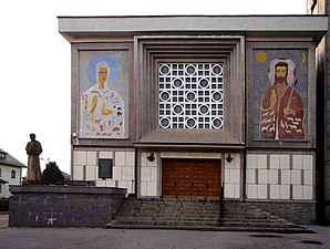 Church of the St. Maksymilian Kolbe
 -
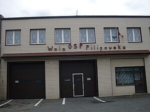 Fire station of Volunteer Fire Department
.jpg)
.jpg)

References
| Town and seat |  | |
|---|---|---|
| Villages | ||
|
| This Lesser Poland Voivodeship location article is a stub. You can help Wikipedia by expanding it. |