Voting period is over. Please don't add any new votes. Voting period ends on 17 Feb 2014 at 07:04:47 (UTC)

- Reason
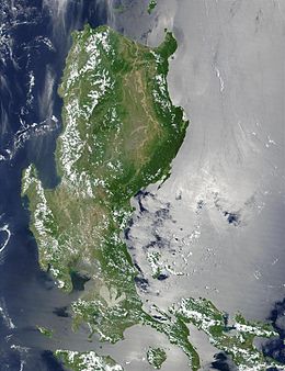
- Incomplete satellite image of Luzon, one of the world's largest and most populated islands
- Articles in which this image appears
- Luzon, Luções, Luzon rainforest, Geography of the Philippines
- FP category for this image
- Wikipedia:Featured pictures/Diagrams, drawings, and maps/Maps
- Creator
- NASA
- Support as nominator -- Theparties ( talk) 07:04, 7 February 2014 (UTC)
- Comment I don't think incomplete photo is passable - indeed, seems to be cut-off at the bottom, compared to the map. Nice though. Brandmeister talk 15:45, 7 February 2014 (UTC)
Not promoted -- Sᴠᴇɴ Mᴀɴɢᴜᴀʀᴅ Wha? 07:35, 17 February 2014 (UTC)