Photos • Location

Whiton, Maryland | |
|---|---|
 Whiton | |
| Coordinates: 38°17′22″N 75°22′37″W / 38.28944°N 75.37694°W | |
| Country | United States |
| State | Maryland |
| Counties | Wicomico, Worcester |
| Elevation | 26 ft (8 m) |
| Time zone | UTC-5 ( Eastern (EST)) |
| • Summer ( DST) | UTC-4 (EDT) |
| Area code(s) | 410 & 443 |
| GNIS feature ID | 591553 [1] |
Whiton is an unincorporated community in Wicomico and Worcester counties in the U.S. state of Maryland. Whiton is located on Maryland Route 354, 7.2 miles (11.6 km) south-southwest of Willards. [2]
References
- ^ "Whiton". Geographic Names Information System. United States Geological Survey, United States Department of the Interior.
- ^ Maryland General Highway Statewide Grid Map: Nassawango Map No. K-17B (PDF) (Map). Maryland Department of Transportation. 2012. Retrieved March 7, 2013.
Municipalities and communities of
Wicomico County, Maryland, United States | ||
|---|---|---|
| Cities |  | |
| Towns | ||
| CDPs | ||
|
Unincorporated communities | ||
| Footnotes | ‡This populated place also has portions in an adjacent county or counties | |
Municipalities and communities of
Worcester County, Maryland, United States | ||
|---|---|---|
| City | 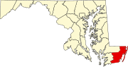 | |
| Towns | ||
| CDPs | ||
|
Other communities | ||
| Footnotes | ‡This populated place also has portions in an adjacent county or counties | |