Photos • Location
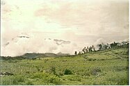
Hills in Viraco District.

Viraco | |
|---|---|
| Country | |
| Region | Arequipa |
| Province | Castilla |
| Capital | Viraco |
| Government | |
| • Mayor | Nazario Zenon Yaulli Neira |
| Area | |
| • Total | 141 km2 (54 sq mi) |
| Elevation | 3,215 m (10,548 ft) |
| Population (
2005 census) | |
| • Total | 1,956 |
| • Density | 14/km2 (36/sq mi) |
| Time zone | UTC-5 ( PET) |
| UBIGEO | 040414 |

Viraco District is one of fourteen districts of the province Castilla in Peru. [1]
References
- ^ (in Spanish) Instituto Nacional de Estadística e Informática. Banco de Información Distrital Archived 2008-04-23 at the Wayback Machine. Retrieved April 11, 2008.
15°40′06″S 72°31′53″W / 15.6683°S 72.5315°W
|
| This Arequipa Region geography article is a stub. You can help Wikipedia by expanding it. |