Photos • Location
Urlândia | |
|---|---|
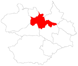
 The bairro in District of Sede | |
 District of Sede, in Santa Maria City, Rio Grande do Sul, Brazil | |
| Coordinates: 29°43′03.10″S 53°49′05.33″W / 29.7175278°S 53.8181472°W | |
| Country | Brazil |
| State | Rio Grande do Sul |
| Municipality/ City | Santa Maria |
| District | District of Sede |
| Area | |
| • Total | 2.7829 km2 (1.0745 sq mi) |
| Population | |
| • Total | 8,967 |
| • Density | 3,200/km2 (8,300/sq mi) |
| Adjacent bairros | Dom Antônio Reis, Duque de Caxias, Lorenzi, Nossa Senhora Medianeira, Patronato, Renascença, São Valentim, Tomazetti, Uglione. |
| Website | Official site of Santa Maria |
Urlândia [2] is a bairro in the District of Sede in the municipality of Santa Maria, in the Brazilian state of Rio Grande do Sul. It is located in south Santa Maria.
Villages
The bairro contains the following villages: Parque Residencial São Carlos, Urlândia, Vila Formosa, Vila Santos, Vila Tropical, Vila Urlândia.
References
