Trinchera, Colorado | |
|---|---|
 Trinchera viewed from a hill just west of town | |
 Trinchera Location in Colorado  Trinchera Location in the United States | |
| Coordinates: 37°02′34″N 104°02′51″W / 37.04278°N 104.04750°W | |
| Country | |
| State | |
| County | Las Animas County [1] |
| Elevation | 1,765 m (5,791 ft) |
| Time zone | UTC-7 ( MST) |
| • Summer ( DST) | UTC-6 ( MDT) |
| ZIP code [2] | 81081 |
| Area code | 719 |
| GNIS feature ID | 0204814 |
Trinchera is an unincorporated community and a U.S. Post Office located in Las Animas County, Colorado, United States. The Trinchera Post Office has the ZIP Code 81081. [2]
A post office called Trinchera has been in operation since 1889. [3] Trinchera is a name derived from Spanish meaning "trench". [4]
Geography
Trinchera is located at 37°02′34″N 104°02′51″W / 37.04278°N 104.04750°W (37.042847,-104.047565).
References
- ^ a b "US Board on Geographic Names". United States Geological Survey. October 25, 2007. Retrieved January 31, 2008.
- ^ a b "ZIP Code Lookup" ( JavaScript/ HTML). United States Postal Service. January 3, 2007. Retrieved January 3, 2007.
- ^ "Post offices". Jim Forte Postal History. Retrieved July 11, 2016.
- ^ Dawson, John Frank. Place names in Colorado: why 700 communities were so named, 150 of Spanish or Indian origin. Denver, CO: The J. Frank Dawson Publishing Co. p. 49.
Municipalities and communities of
Las Animas County, Colorado, United States | ||
|---|---|---|
| City | 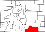 | |
| Towns | ||
| CDPs | ||
|
Unincorporated communities | ||
| Ghost towns | ||