Photos • Location

Torup | |
|---|---|
Village | |
 Domes in Dyssekilde ecovillage in Torup | |
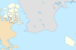
| Coordinates: 55°58′58″N 11°56′31″E / 55.98278°N 11.94194°E | |
| Country | |
| Region | Capital Region |
| Municipality | Halsnæs |
| Population (2024) | |
| • Urban | 374 |
| Time zone | UTC+1 ( GMT) |
| Postal code | 3390 Hundested |
You can help expand this article with text translated from
the corresponding article in Danish. (January 2024) Click [show] for important translation instructions.
|
Torup is a village located on the Halsnæs peninsula in North Zealand, Denmark.
The village is located midway between the towns of Frederiksværk and Hundested, some 60 km north of Copenhagen, Denmark. It is located in Halsnæs Municipality, in the Capital Region of Denmark. As of 1 January 2024, the population was 374. [1]
The village was originally the main town on the Halsnæs peninsula, probably arising around Torup Church from the 12th century, which is still the main church in Torup Parish. [2] Later, Hundested became by far the largest town on Halsnæs. The village is served by Dyssekilde railway station, which is on the Frederiksværk Line between Hillerød and Hundested.
See also
References
- ^ BY3: Population 1st January by urban areas, area and population density The Mobile Statbank from Statistics Denmark
- ^ "Torup Kirke". torupsogn.dk (in Danish). Torup Parish. Retrieved 29 January 2024.
External links
Wikimedia Commons has media related to
Torup (Halsnæs).


