Photos • Location
| The Beacon | |
|---|---|
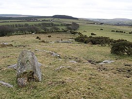
 Southern slopes of The Beacon below
Elephant Rock. | |
| Highest point | |
| Elevation | 369 m (1,211 ft) [1] |
| Prominence | 91 m (299 ft) [1] |
| Listing | TuMP, sub- HuMP |
| Coordinates | 50°35′11″N 4°33′02″W / 50.5865°N 4.5505°W |
| Geography | |
| Location | Bodmin Moor, England |
| OS grid | SX196792 |
| Topo map | OS Landranger 201, Explorer 109 |
The Beacon on Hendra Downs is a prominent hill, 369 metres (1,211 ft) high, located on the northeastern side of Bodmin Moor in the county of Cornwall, England. [2]
References
- ^ a b Hendra Downs (The Beacon) at www.hill-bagging.co.uk. Retrieved 28 Dec 2016.
- ^ Ordnance Survey 1:25,000 Explorer map series, No. 109