| This is the
talk page for discussing improvements to the
Jammu division article. This is not a forum for general discussion of the article's subject. |
Article policies
|
| Find sources: Google ( books · news · scholar · free images · WP refs) · FENS · JSTOR · TWL |
|
| This article is rated C-class on Wikipedia's
content assessment scale. It is of interest to the following WikiProjects: | ||||||||||||||||
| |||||||||||||||||

"Population • Total 13,79,678" Even number format is wrong. It should be 5,350,811, according to the 2011 census. — Preceding unsigned comment added by 91.232.36.10 ( talk) 09:41, 31 January 2013 (UTC)
This paragraph clearly represents an Indian point of view that “ Jammu is one of the three regions comprising the Indian state of Jammu and Kashmir.The Pir Panjal range of mountains seperates Jammu from the Kashmir valley. Jammu borders Kashmir valley to the north, Ladakh to the east, Himachal Pradesh to the south and Pakistan occupied Kashmir to the west.”
The state of Jammu and Kashmir is a disputed territory therefore it cannot be called “the Indian state of Jammu and Kashmir”
Maakhter 11:33, 2 July 2006 (UTC)
Maybe the article can be re-worded. However, the truth as it stands today, is that there is an pakistan "occupied" kashmir and indian "administered" kashmir
- I don't see anything wrong with the wordings. The dispute over Kashmir is already mentioned in the Jammu and Kashmir (J&K) and Kashmir article. Jammu is just a sub-region within the state of Jammu and Kashmir. It is illogical to mention the Kashmir dispute in every article related to J&K.
Truth is that Pakistan and India Occupied our Kingdom by force to steel our sources —Preceding unsigned comment added by 86.81.37.33 ( talk) 14:55, 20 March 2010 (UTC)
There are several reasons to merge this page:
1- Kashmir page, Jammu and Kashmir page, and this page are supposed to be showing exactly the same subject.
2- These pages have a large overlap.
This page should be organized like Kashmir page.
- I don't think the page should be merged. This page should deal with Jammu as a separate city or indeed state, which doesn't then directly overlap with Kashmir or J&K.
- It does need a bit of cleaning up, though. -- TinaSparkle 19:46, 17 September 2006 (UTC)
There are three articles: Jammu, Jammu (city), and Jammu Tawi. They should all be merged into one article, preferably Jammu Tawi as this is the name of the town, with redirects from the other two. Vedabit ( talk) 05:11, 14 May 2012 (UTC)
- Vote AGAINST merger. Plenty of people, including me, come here to read about the 'Jammu' part of 'Jammu and Kashmir' It's an official, govt defined region, with its own govt. web page. It needs its own page. Merging it would be MORE confusing and less informative. jackbrown ( talk) 20:12, 2 October 2013 (UTC)
This page should be organized like Kashmir page. Furthermore, this page is clearly showing pro-Indian bias.
I would hope that people would read the article before labelling it as biased. I would like an example of this supposed bias, so that I can be illuminated as to the location whence I may find it. —Preceding unsigned comment added by 216.47.136.60 ( talk) 00:03, 6 May 2008 (UTC)
are the indians blind this article doesnt even state that jammu is administered by india is a disputed territory. —Preceding
unsigned comment added by
86.162.70.177 (
talk)
19:17, 28 July 2008 (UTC)
== Administered territory ==
Jammu is administered by India why is there no mention of this? —Preceding unsigned comment added by Nangparbat ( talk • contribs) 16:40, 4 August 2008 (UTC)
Every body knows we are on the top of indian map don't worry mate.
Shouldnt there be different articles for the city of Jammu, Jammu District and Jammu region -- PlaneMad| YakYak 08:51, 15 April 2007 (UTC)
- Yes. Definitely. I'll work on this. Anyone interested, please feel free to join. Thanks. --
GDibyendu (
talk)
18:12, 22 July 2008 (UTC)
- I've tagged the article to make this issue still more imperative. __ meco ( talk) 10:58, 4 December 2008 (UTC)
Kingdom of Jammu Kashmir is under the occupation of Pakistan and India while people want to live in peace with China Inida and Pakisan with out occupation —Preceding unsigned comment added by 86.81.37.33 ( talk) 15:02, 20 March 2010 (UTC)
I mistakenly added db-spam tag to article, I apologize for that. Tag is removed now. Oniongas ( talk) 18:22, 24 April 2009 (UTC)
How many temples are we describing- one, two or three? I started copyediting this section, but couldn't tell if there were redundancies in the descriptions or these were actually different temples. One is described as within the fort, another is on the bank of the river, another across the road. Vontrotta ( talk) 19:52, 10 July 2009 (UTC)
{{
editsemiprotected}}
please add url/weblink of Mahant Bachittar Singh College as www.mbscet.org 115.117.147.40 ( talk) 18:26, 15 May 2010 (UTC)
- See WP:EL please. — fetch · comms 18:32, 15 May 2010 (UTC)
{{ editsemiprotected}}
I have some more information and images of jammu which are useful. Coolansh63 ( talk) 07:14, 11 July 2010 (UTC)
 Not done: please be more specific about what needs to be changed. You can upload those image taking a look
here, provided they don't infringe copyright.
Salvio (
Let's talk 'bout it!)
10:23, 11 July 2010 (UTC)
Not done: please be more specific about what needs to be changed. You can upload those image taking a look
here, provided they don't infringe copyright.
Salvio (
Let's talk 'bout it!)
10:23, 11 July 2010 (UTC)
{{
editsemiprotected}}
http://www.jammu.com/ is a website based on comprehensive information on Jammu – Travel Destinations, Tourists Attractions, Festivals, Shrines, Current Events, Accommodation, and much more
Rajansachdev ( talk) 05:02, 14 July 2010 (UTC)
- This website needs to be considered. It provides additional information about sacred place or shrines, festivals, fairs and tourist attractions in Jammu. However, its reliability is questionable. I can't find contact details on the website. It doesn't appear to be backed by an organisation. I personally wouldn't add it. Davtra ( talk) 08:22, 14 July 2010 (UTC)
![]() Not done: Unreliable
external link.
Spigot
Map
13:15, 14 July 2010 (UTC)
Not done: Unreliable
external link.
Spigot
Map
13:15, 14 July 2010 (UTC)
| Jammu
| |
| Main languages | Dogri, Urdu, Hindi |
| Area | 32,059 km2 [1] |
| Population (2001) | 49,29,335 [2] |
| Birth rate (2001) | |
| Death rate (2001) | |
| Infant mortality rate (1981) | |
| Website | http://jammu.nic.in/ |
The table here on the right was in the article. This table seems not be able to difference between city and district. Also it is not in line with the tables used by cities and states in india. -- Tomdo08 ( talk) 02:33, 24 October 2010 (UTC)

|
An image used in this article,
File:Jammu, Kashmir and Ladakh.JPG, has been nominated for speedy deletion at
Wikimedia Commons for the following reason: Copyright violations
Don't panic; deletions can take a little longer at Commons than they do on Wikipedia. This gives you an opportunity to contest the deletion (although please review Commons guidelines before doing so). The best way to contest this form of deletion is by posting on the image talk page.
To take part in any discussion, or to review a more detailed deletion rationale please visit the relevant image page (File:Jammu, Kashmir and Ladakh.JPG) This is Bot placed notification, another user has nominated/tagged the image -- CommonsNotificationBot ( talk) 09:30, 4 March 2012 (UTC) |
This
edit request has been answered. Set the |answered= or |ans= parameter to no to reactivate your request. |
There is a line in opening paragraph that Jammu is officially called Jammu-Tawi, it is not the case Jammu-Tawi is name of Railway station and not an official name of Jammu. Mukulrajsingh ( talk) 01:24, 2 April 2012 (UTC)
![]() Not done: please provide
reliable sources that support the change you want to be made.
Celestra (
talk)
14:50, 2 April 2012 (UTC)
Not done: please provide
reliable sources that support the change you want to be made.
Celestra (
talk)
14:50, 2 April 2012 (UTC)
This
edit request has been answered. Set the |answered= or |ans= parameter to no to reactivate your request. |
223.184.99.71 (
talk)
06:27, 5 July 2012 (UTC)
- Not done: please be more specific about what needs to be changed. You have made no request.
Rivertorch (
talk)
10:57, 5 July 2012 (UTC)
The map of the districts within Jammu and Kashmir contains an error: The coloring indicates that Poonch (number 6) is part of Kashmir, while it is actually part of Jammu. — Preceding unsigned comment added by 217.248.202.239 ( talk) 00:51, 3 October 2012 (UTC) 36 Sarpanches, 300 panches resign from the membership of NC from Block Surankote and Bafliaz
The recent reshuffle in the council of ministry proved fatal for the region of Rajouri-Poonch, as against expectations not a single face was included in the ministry from the twin districts by national conference. It is pertinent to mention here that there are seven legislative seats in this region and out of them three are represented by National Conference but still NC failed to include any one in the council of ministers.
Adding to the woes of people of Rajouri-Poonch Syed Mushtaq Ahmad Shah Bukhari has been dropped from the post of (MoS) Vice Chairman Pahari Advisory Board. On hearing the removal of Syed Mushtaq Bukhari a strong wave of sorrow and anger gripped Pir-Panjal range. Showing strong resentment to this all the Panches and Sarpanches of Block Surankote and Bufliaz resigned from the membership of National Conference today in a conference held at press club Jammu. Speaking on the occasion Sarpanch Mohd Bashir Khattak ridiculed the decision of party high command to remove Mr. Bukhari from the post of Vice chairman.
He said that national conference has always treated Rajouri-Poonch in a step motherly way and the only representation it had in some sense has even been taken away. He also reminded that the struggle against National Conference for its behavior will be intensified in the coming days.
Other Sarpanches who were present on the occasion and resigned from the membership of party include Sarpanch Syed Fida Hussain Shah Pamrote, Sarpanch Mohd Aslam Choudhary Mastandara, Sarpanch Abdul Hamid Lassana, Sarpanch Babu Khan Bufliaz (B), Sarpanch Maroof Khan Bufliaz (A), Sarpanch Bashir Malik bunikhet, Sarpanch Manzoor Ahmed Charak Marha, Sarpanch Muzaffar Hussain Hari, Sarpanch Amin Khawaja Lathoong, Sarpanch Mohd Aslam Kohli Kalar Kattal, Sarpanch Vilayat Hussain Shah Phagla — Preceding unsigned comment added by 14.139.86.66 ( talk) 12:54, 17 January 2013 (UTC)
This
edit request has been answered. Set the |answered= or |ans= parameter to no to reactivate your request. |
Education
| Educational Institutes |
|---|
| The following discussion has been closed. Please do not modify it. |
|
B.Ed Colleges SNO Medical / Ayurvedic Colleges NAME OF THE COLLEGE OFFICE PHONE 1 Government Medical College, Jammu 2584234, 2584247, 2584290-94 (PBX) 2586495, 9419180707 2 Acharya Sri Chander College of Medical Science & Hospital,Sidhra, Jammu 2662270, 2662360, 2662536-39 (PBX) 2430389, 2431035, 9419183349 3 Institute of Ayurveda and Research, Nardhani Raipur (Kot-Bhalwal Road), Jammu 2594262, 2597868 2591014, 9419191536, 9419193935 |
Please update the educational institutes of Jammu
[4]
Asheemdatta (
talk)
16:27, 22 April 2013 (UTC)
 Not done, Wikipedia is not a directory, it's an encyclopedia, and it cannot contain the list of all the institutes of any city.
Faizan -
Let's talk!
14:16, 23 April 2013 (UTC)
Not done, Wikipedia is not a directory, it's an encyclopedia, and it cannot contain the list of all the institutes of any city.
Faizan -
Let's talk!
14:16, 23 April 2013 (UTC)
Hello fellow Wikipedians,
I have just modified one external link on Jammu Division. Please take a moment to review my edit. If you have any questions, or need the bot to ignore the links, or the page altogether, please visit this simple FaQ for additional information. I made the following changes:
- Added archive https://web.archive.org/web/20160815210807/http://pahar.in/mountains/Books%20and%20Articles/Indian%20Subcontinent/1961%20Gulab%20Singh%20and%20Creation%20of%20Dogra%20State%20of%20Jammu%20Kashmir%20and%20Ladakh%20by%20Huttenback%20from%20J%20Asian%20Studies%20v20%20s.pdf to http://pahar.in/mountains/Books%20and%20Articles/Indian%20Subcontinent/1961%20Gulab%20Singh%20and%20Creation%20of%20Dogra%20State%20of%20Jammu%20Kashmir%20and%20Ladakh%20by%20Huttenback%20from%20J%20Asian%20Studies%20v20%20s.pdf
When you have finished reviewing my changes, you may follow the instructions on the template below to fix any issues with the URLs.
This message was posted before February 2018.
After February 2018, "External links modified" talk page sections are no longer generated or monitored by InternetArchiveBot. No special action is required regarding these talk page notices, other than
regular verification using the archive tool instructions below. Editors
have permission to delete these "External links modified" talk page sections if they want to de-clutter talk pages, but see the
RfC before doing mass systematic removals. This message is updated dynamically through the template {{
source check}} (last update: 5 June 2024).
- If you have discovered URLs which were erroneously considered dead by the bot, you can report them with this tool.
- If you found an error with any archives or the URLs themselves, you can fix them with this tool.
Cheers.— InternetArchiveBot ( Report bug) 19:26, 18 April 2017 (UTC)
ImrannGhazi, can you explain where in the source is this content supported?
-- Kautilya3 ( talk) 09:34, 14 July 2018 (UTC)
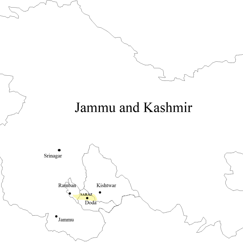
The map used in the article needs updating as it is obsolete and doesn't reflect the contemporary status of districts and boundaries of the division. Just for example there's no mention or outline of districts Samba and Ramban, the latter being the link between Jammu and Kashmir division. I request fellow editors to please upload a new and update map for the division. Also, I do not feel that there is a need for uploading the whole map of J&K including the disputes, this article is only about Jammu Division and therefore, the map should reflect that only. If need be other map can be added too. pinging DiplomatTesterMan Kautilya3 Amazingcaptain for inputs. AnM2002 ( talk) 13:47, 31 May 2020 (UTC)
- I don't see any problem with the map. Can we give up all these political gimmicks, and focus on real information? There is a lot going in the world right now. -- Kautilya3 ( talk) 14:38, 31 May 2020 (UTC)
- @ User:Kautilya3 Don't pass gibberish statements if you can't properly infer the matter/language. I clearly, mentioned in the beginning of my discussion that the map does not show the newly created Districts like Ramban,Samba. Is that a political gimmick ? Being an old user it doesn't befit u to have this repeated haphazard/unthoughtful approach in discussions. AnM2002 ( talk) 15:10, 31 May 2020 (UTC)
- @ User:Kautilya3 the second part is just an opinion of mine, which I wanted to discuss , rather than selectively pitching it as a political gimmick present something substantial that befits your edit count. Why do you always jump the gun when it comes to discussing something? these might help ( WP:GF) ( WP:BITE) ( WP:EQ) AnM2002 ( talk) 15:15, 31 May 2020 (UTC)
- what is the fun of having a map about a division which doesn't reflect the administrative subdivisons correctly? Is this real information ? AnM2002 ( talk) 15:20, 31 May 2020 (UTC)
- Well, I checked the map and saw Jammu Division marked by orange boundary. The map is not entirely obsolete as geographic area still remains the same after the formation of new districts. But replacing it with an updated one shall indeed be helpful. I think updating it is a good idea, but still map should depict the entire union territory of Jammu and Kashmir with Jammu Division marked with some other color to make things clear.
AnM2002, you may proceed, per
WP:BOLD. I'm quite busy these days and can't perform major edits. —
The Ultimate
Let's Talk
21:51, 31 May 2020 (UTC)
- @ The Ultimate: thanks for your inputs. I am not against displaying the whole map, just wanted a more Informative one.
- Well, I checked the map and saw Jammu Division marked by orange boundary. The map is not entirely obsolete as geographic area still remains the same after the formation of new districts. But replacing it with an updated one shall indeed be helpful. I think updating it is a good idea, but still map should depict the entire union territory of Jammu and Kashmir with Jammu Division marked with some other color to make things clear.
AnM2002, you may proceed, per
WP:BOLD. I'm quite busy these days and can't perform major edits. —
The Ultimate
Let's Talk
21:51, 31 May 2020 (UTC)
AnM2002, before talking about placing the map in the article, why don't we all (you) actually just create the map. This in itself will a useful contribution and simplify the next stage of the discussion for you? DTM ( talk) 06:39, 1 June 2020 (UTC)
@ DiplomatTesterMan: that's the point of this discussion, I am not very thorough with map creation and commons copyright rules so i thought it would be better to involve more experienced editors and discuss the approach. AnM2002 ( talk) 07:41, 1 June 2020 (UTC)
- AnM2002 Give me some days, my to-do list is already ten lifetimes long. That is if no one does it first of course. Cheers. DTM ( talk) 11:07, 2 June 2020 (UTC)
No worries @ DiplomatTesterMan: the issue is on talkpage, we'll work it out. Good to see that there are still editors here who are willing to collaborate and not BITE others frequently, boasting their edit count! AnM2002 ( talk) 16:06, 2 June 2020 (UTC)
RaviSharma21, I am not confident that your edits were genuinely regarding the Jammu Division, not those of the Jammu District. For instance, you removed Kashmiri as a language spoken in the Division. You have also added "Duggar Pradesh" as a local name. You really need to demonstrate that each and every one of your edits pertain to the entire Division. Otherwise, I am minded to revert all of them. -- Kautilya3 ( talk) 08:23, 16 October 2020 (UTC)
 |
There is a map on the page that was subject to a
revert yesterday. It is a lovely map and it shows the district boundaries as they were before the State Government reorganised them, which I think happened in July 2006.
[1] I am not sure whether July 2006 was the date of the decision for Doda district, or the date of implementation. It would be useful to recaption the map to explain that they are not the current district boundaries, and to move it to the article on the
list of districts of Jammu and Kashmir. Doda district was created in 1948 from part of Udhampur district in 1948.
[1] So the map may show the district boundaries from 1948 1979 to 2006. But there may have been other changes, so more research would probably be useful. --
Toddy1
(talk)
11:25, 5 December 2020 (UTC)
- Samba district was created by Government order No. 1345 GAD of 2006 dated 27 October 2006. [2]
- Budgam, Kupwara, and Pulwama districts (in Kashmir Division) and Kargil district (in Ladakh) were created in 1979. [3]
References
- ^ a b Singh, Mubarak; Balwan, Yasir L. A. District Doda at a Glance 2013-14 (PDF) (Report). District Statistics& Evaluation Office Doda, Government of Jammu and Kashmir Planning and Development Department. p. 1.
- ^ "History". District Samba (Jammu and Kashmir), Government of Jammu and Kashmir. Retrieved 5 December 2020.
- ^ Qureshi, G.A. Socio-Economic Profile of Jammu & Kashmir 2008 (PDF) (Report).
-- Toddy1 (talk) 12:08, 5 December 2020 (UTC)
"The Chenab Valley and Pir Panchal are other important regions in the Jammu division." not directly supported by source
I have deleted the following statement from lead paragraph (but only after correcting the citation templates:
- The Chenab Valley and Pir Panchal are other important regions in the Jammu division. [1] [2]
References
- ^ "Geelani vows to resist settlement of retired soldiers in Kashmir". Greater Kashmir. 23 July 2015. Archived from the original on 3 October 2015.
- ^ "Through the Pir Panjal". Frontline (magazine). Date possibly 3 October 2015.
I looked at the Greater Kashmir article cited. Though it mentions the Chenab Valley and Pir Panchal, there is no clear and direct statement in the Greater Kashmir article that supports the Wikipedia sentence. The Frontline article is behind a paywall. It must have been published on or before 3 October 2015, because that is the first time the web archive has a return for it (the return states that access is forbidden). Given that the Greater Kashmir article does not support the statement it is cited for, it is hard to have much confidence that the Frontline article does. If anyone has access to the Frontline article and can tell us how it supports the statement, please feel free to put the statement back into the article (though without the citation to the Greater Kashmir article.-- Toddy1 (talk) 16:06, 15 December 2020 (UTC)
- There are proposals to give them "Hill Development Councils".
[1] --
Kautilya3 (
talk)
09:43, 16 December 2020 (UTC)
- Well, if the hill development councils happen, we can say that they have hill development councils. That does not support the claim that they are "important regions".-- Toddy1 (talk) 09:48, 16 December 2020 (UTC)
An IP editor has objected to the following sentence, giving the reason: citation is false: [2]
- It is also known as Duggar Pradesh. [1]
References
- ^ "Glimpses of Duggar Pradesh". State Times. 2020-09-01. Retrieved 2020-09-24.
The link is a dead link. I cannot find an archived copy on web.archive.org. A search on the newspaper website did not produce a result. [3] -- Toddy1 (talk) 07:35, 13 January 2021 (UTC)
- There is a copy available at Early Times. I think it is better to reword the sentence as "The region was historically known as Duggar Pradesh". -- Kautilya3 ( talk) 10:55, 13 January 2021 (UTC)
@ TheChunky: There is a huge and unexplained difference between what the 2011 census documents says about the area of Kishtwar district, and what the district authority says.
- District Census Handbook Kishtwar, Part B (PDF). Census of India 2011 (Report). 18 June 2014. pp. 9, 10, 22. Retrieved 21 November 2020. – total area = 1644 sqkm
- "District Kishtwar". Kishtwar.nic.in. Retrieved 23 February 2021. – total area = 7737 sqkm
It would help a lot to try and understand this.-- Toddy1 (talk) 09:07, 23 February 2021 (UTC)
- Yes, there is difference. But I have preferred the authority because I am resident of this area and I believe Authority is right there. Also, I wanted to change
Doda district area there because Doda district is smaller than Kishtwar (in area). This difference is easily observed in the maps or this specific map of erstwhile Doda district (now
Chenab Valley) Url:
"image of Chenab Valley map". . —
The Chunky urf Al Kashmiri
(Speak🗣️ or Write✍️)
- The question is then, what do the areas in the census documents mean? i.e. why are they so different?--
Toddy1
(talk)
16:13, 24 February 2021 (UTC)
- The census handbook is only giving the "rural area", using which one can calculate the population density.
The district is mostly made of mountain area, whch is probably not included here. --
Kautilya3 (
talk)
18:29, 24 February 2021 (UTC)
- I tried to test that theory. I searched for an Indian government website that gave the area of J&K on the Indian side of the LoC. I found
knowindia.gov.in, which says:
- Area of Jammu & Kashmir: 222,236 sq km (this is the same as District Census Handbook Kishtwar, Part B, page 11)
- Geographical area of J&K: 101,387 sq km on this side of actual line of control. This is the same as the sum of the district areas that were taken from census documents.
- Area of forest in J&K: 20,230 sq km
- knowindia.gov.in gives a breakdown of forest with percentages by division. The percentages are exactly the same as you would calculate from the sum of the district areas in the census documents.
- I tried to test that theory. I searched for an Indian government website that gave the area of J&K on the Indian side of the LoC. I found
knowindia.gov.in, which says:
- The census handbook is only giving the "rural area", using which one can calculate the population density.
The district is mostly made of mountain area, whch is probably not included here. --
Kautilya3 (
talk)
18:29, 24 February 2021 (UTC)
- The question is then, what do the areas in the census documents mean? i.e. why are they so different?--
Toddy1
(talk)
16:13, 24 February 2021 (UTC)
Area from Census [1] Geographical Area on Indian side of LoC [2] Forest [2] % Forest in Geographical Area [2] Kashmir Valley 15,948 - 8,128 50.97% Jammu division 26,293 - 12,066 45.89% Ladakh region 59,146 - 36 0.06% J&K State 101,387 101,387 20,230 19.95% References
- ^ See Jammu and Kashmir (state)#Districts. The data on areas in that were taken from census documents and are all cited.
- ^ a b c knowindia.gov.in
- Evidently knowindia.gov.in are taking the areas in the census documents to be the geographical area.-- Toddy1 (talk) 22:25, 24 February 2021 (UTC)
- District Census Handbook Kishtwar, Part B, page 10, 12 Page 12 quotes a density for Kishtwar district of 140 persons/sq km. Page 12 note (d) says "Density of population is calculated on the basis of revenue area of the district." You get that density when you use 230,696 (or 231,037) as the population and 1644 as the area.
- Similarly for J&K District Census Handbook Kishtwar, Part B, page 10 gives a density of 124. You get that density if you use an area of about 101,387 sq km for J&K.
- So these areas being quoted in the census documents are the "revenue area". But some bits of the Indian government are labelling them as the geographical area (which they probably are not). -- Toddy1 (talk) 23:03, 24 February 2021 (UTC)
- I checked CHAPTER I, Jammu and Kashmir : An Introductory Profile which uses 2001 data, and its "geographical areas" for districts in Jammu Division are the same as the ones with have for before 2007 in the table in Jammu and Kashmir (state)-- Toddy1 (talk) 23:19, 24 February 2021 (UTC)
- C-Class India articles
- Mid-importance India articles
- C-Class India articles of Mid-importance
- C-Class Indian cities articles
- Mid-importance Indian cities articles
- C-Class Indian cities articles of Mid-importance
- WikiProject Indian cities articles
- C-Class Jammu and Kashmir articles
- High-importance Jammu and Kashmir articles
- C-Class Jammu and Kashmir articles of High-importance
- WikiProject Jammu and Kashmir articles
- WikiProject India articles