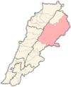
Photos • Location
Talia
طليا | |
|---|---|
Village | |
| Coordinates: 33°56′10″N 36°05′50″E / 33.93611°N 36.09722°E | |
| Country | |
| Governorate | Baalbek-Hermel Governorate |
| District | Baalbek District |
| Elevation | 1,130 m (3,710 ft) |
| Time zone | UTC+2 ( EET) |
| • Summer ( DST) | +3 |
Talia ( Arabic: طليا) is a municipality in Baalbek District, 73 kilometers from Beirut. Its elevation is 1030 meters above sea level. [1]
The population is mostly Greek Orthodox Christian. [2]
References
- ^ "Talia". Localiban. Retrieved 22 July 2015.
- ^ "Mapping Lebanon's towns and neighborhoods shows diaspora registration clusters". L'Orient Today. 2022-05-10. Retrieved 2022-07-23.

