Photos • Location
Saucepampa
Sawsipampa | |
|---|---|
 | |
| Country | |
| Region | Cajamarca |
| Province | Santa Cruz |
| Founded | September 1, 1989 |
| Capital | Saucepampa |
| Government | |
| • Mayor | Ernesto Suxe Palomino |
| Area | |
| • Total | 31.58 km2 (12.19 sq mi) |
| Elevation | 1,875 m (6,152 ft) |
| Population (
2005 census) | |
| • Total | 2,079 |
| • Density | 66/km2 (170/sq mi) |
| Time zone | UTC-5 ( PET) |
| UBIGEO | 061308 |
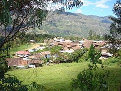
Saucepampa or Sawsipampa ( Quechua) is one of eleven districts of the province Santa Cruz in Peru. [1]
References
- ^ (in Spanish) Instituto Nacional de Estadística e Informática. Banco de Información Distrital Archived 2008-04-23 at the Wayback Machine. Retrieved April 11, 2008.