Photos • Location

Saint-Andéol-de-Clerguemort | |
|---|---|
Part of
Ventalon-en-Cévennes | |
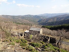
 A view from the hamlet of Espinas, in Saint-Andéol-de-Clerguemort | |
| Coordinates: 44°17′34″N 3°54′29″E / 44.2928°N 3.9081°E | |
| Country | France |
| Region | Occitania |
| Department | Lozère |
| Arrondissement | Florac |
| Canton | Le Collet-de-Dèze |
| Commune | Ventalon-en-Cévennes |
| Area 1 | 6.86 km2 (2.65 sq mi) |
| Population (2019)
[1] | 93 |
| • Density | 14/km2 (35/sq mi) |
| Time zone | UTC+01:00 ( CET) |
| • Summer ( DST) | UTC+02:00 ( CEST) |
| Postal code | 48160 |
| Elevation | 379–970 m (1,243–3,182 ft) (avg. 500 m or 1,600 ft) |
| 1 French Land Register data, which excludes lakes, ponds, glaciers > 1 km2 (0.386 sq mi or 247 acres) and river estuaries. | |
Saint-Andéol-de-Clerguemort (French pronunciation: [sɛ̃.t‿ɑ̃deɔl də klɛʁɡəmɔʁ]; Occitan: Sent Andiòu del Clèrguemòrt) is a former commune in the Lozère department in southern France. [2] On 1 January 2016, it was merged into the new commune of Ventalon-en-Cévennes. [3] Its population was 93 in 2019. [1]
See also
References
- ^ a b Téléchargement du fichier d'ensemble des populations légales en 2019, INSEE
- ^ Des villages de Cassini aux communes d'aujourd'hui: Commune data sheet Saint-Andéol-de-Clerguemort, EHESS (in French).
- ^ Arrêté préfectoral 14 December 2015
Wikimedia Commons has media related to
Saint-Andéol-de-Clerguemort.


