Photos • Location

Saginaw, Arkansas | |
|---|---|
 Saginaw  Saginaw | |
| Coordinates: 34°18′01″N 92°56′11″W / 34.30028°N 92.93639°W [1] | |
| Country | United States |
| State | Arkansas |
| County | Hot Spring |
| Elevation | 322 ft (98 m) |
| Time zone | UTC-6 ( Central (CST)) |
| • Summer ( DST) | UTC-5 (CDT) |
| Area code | 501 |
Saginaw is an unincorporated community in Hot Spring County, Arkansas, United States. [1]
The community is located on the Old Military Road (County Road 15) three-quarters of a mile east of Interstate 30, approximately one mile west of the Ouachita River and three miles southwest of Social Hill. [2] Saginaw is 8.3 miles (13.4 km) west-southwest of Malvern.
References
- ^ a b c d "Saginaw". Geographic Names Information System. United States Geological Survey, United States Department of the Interior.
- ^ Social Hill, AR, 7.5 Minute Topographic Quadrangle, USGS, 1978
Municipalities and communities of
Hot Spring County, Arkansas, United States | ||
|---|---|---|
| Cities | 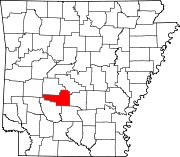 | |
| Towns | ||
| Townships | ||
| CDPs | ||
|
Other unincorporated communities | ||
|
| This article about a location in Hot Spring County, Arkansas is a stub. You can help Wikipedia by expanding it. |