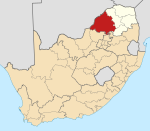
Photos • Location
Roedtan | |
|---|---|
| Coordinates: 24°35′54″S 29°04′50″E / 24.59833°S 29.08056°E | |
| Country | South Africa |
| Province | Limpopo |
| District | Waterberg |
| Municipality | Modimolle–Mookgophong |
| Area | |
| • Total | 1.00 km2 (0.39 sq mi) |
| Population (2011)
[1] | |
| • Total | 98 |
| • Density | 98/km2 (250/sq mi) |
| Racial makeup (2011) | |
| • Black African | 83.7% |
| • White | 16.3% |
| First languages (2011) | |
| • Northern Sotho | 41.7% |
| • Tsonga | 20.8% |
| • English | 13.5% |
| • Afrikaans | 11.5% |
| • Other | 12.5% |
| Time zone | UTC+2 ( SAST) |
| PO box | 0580 |
| Area code | 015 |
Roedtan is a small town in the Limpopo province, South Africa, set in the midst of the Springbok Flats. Roedtan has a railroad station 85 km (53 mi) from Polokwane.
The cave Makapansgat is now known to record early hominid occupation (1,500,000 years ago) and is a national monument. The Springbok Flats is a reminder that great herds of Springbok once populated the plain, which was also frequented by lions and other wild animals.[ citation needed]
References
- ^ a b c d "Main Place Roedtan". Census 2011.


