Photos • Location

| Rocha | |
|---|---|
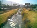
 A bridge across the Rocha River (in the middle) in
Quillacollo | |
| Native name | Kunturillu ( Quechua) |
| Location | |
| Country | Bolivia |
| Region | Cochabamba Department |
| Physical characteristics | |
| Mouth | Caine River |
| Basin features | |
| Tributaries | |
| • left | Pukara Mayu |
| • right | Tapacari River,
Ch'aki Mayu, Wiluma, Chilla, Tupuraya |
Rocha River or Kunturillu River ( Quechua kunturillu black and white, [1] [2] Hispanicized spelling Condorillo, also Kundurillu, Kunturillo) [3] which upstream is called Mayllanku (Maylanco) is a Bolivian river in the Cochabamba Department, Quillacollo Province. [4] From the point of the confluence with the Arque River the river is called Caine River.
The river owes its present name to Captain Martín de la Rocha who diverted the river in 1565.
Gallery
-
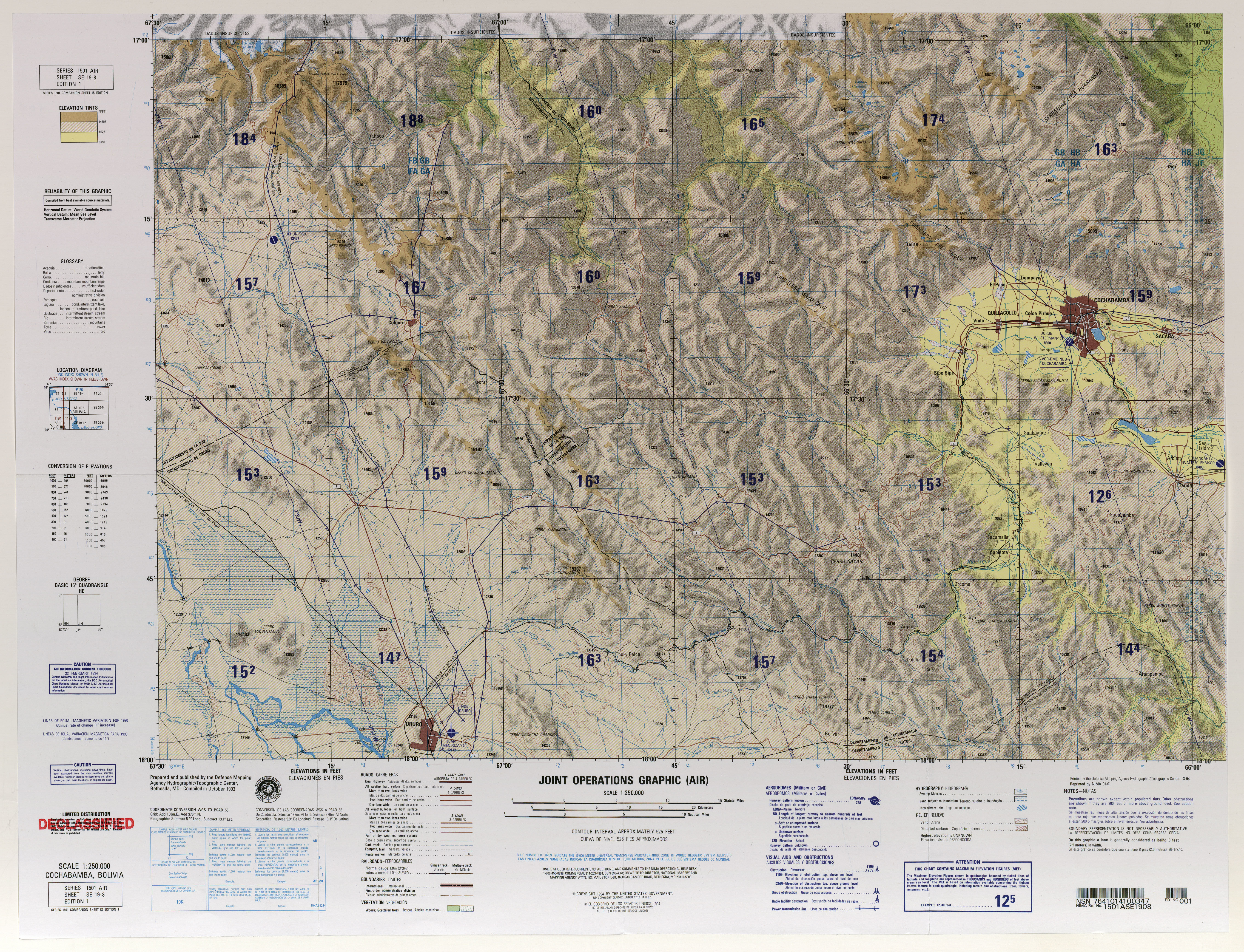
 Map of Cochabamba showing Rocha River as it flows west from Sacaba to Quillacollo and then turning to the south
 -
 Rocha River


See also
Sources and notes
- ^ Teofilo Laime Ajacopa, Diccionario Bilingüe Iskay simipi yuyayk'ancha, La Paz, 2007 (Quechua-Spanish dictionary)
- ^ Note: Black and white like the bird condor (Quechua: kuntur)
- ^ cocha-banner.org Cultural Corner - The River Rocha or Kundurillu (in Spanish and in English)
- ^ contraloria.gob.bo[ permanent dead link] Map of the Rocha River basin
- lib.utexas.edu Detailed map of the area
- Rand McNally, The New International Atlas, 1993.
17°42′10″S 66°14′45″W / 17.7028°S 66.2458°W