Photos • Location


Chien Tang River Bridge | |
|---|---|
 Qiantang River Bridge in 2024 | |
| Coordinates | 30°11′43″N 120°08′04″E / 30.19517°N 120.13456°E |
| Carries | Road and railway |
| Crosses | Chien Tang River |
| Locale | Hangzhou, China |
| Characteristics | |
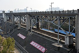
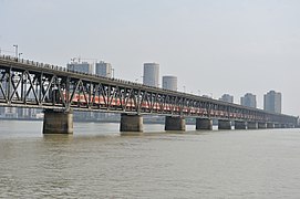
| Design | Two-tier Truss bridge |
| Total length | 1,072 metres |
| Width | 9.1 meters wide |
| History | |
| Constructed by | Dorman Long |
| Construction end | 29 September 1937 |
| Opened | 29 September 1937 |
| Location | |
|
| |
The Qiantang River Bridge ( Chinese: 钱塘江大桥) is a combined road and railway bridge across the Qiantang River at Hangzhou in Zhejiang Province, China.
The bridge was designed by Mao Yisheng [1] and built by Dorman Long. [2] Construction, which started on 8 August 1934 was completed on 29 September 1937. [3] This two-tier truss bridge comprises 16 spans and measures 1,072 metres long. [3]
On 17 November 1937, during the Battle of Shanghai, the Bridge Construction Office were ordered to make preparations to blow up the bridge to delay the advancing Imperial Japanese Army. [4]
-
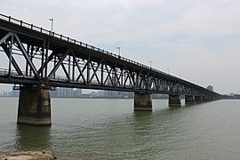 General view
 -
 View of the left bank access
 -
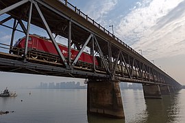 Passing train.
 -
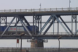 Double deck detail.
 -
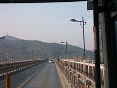 View of the upper deck.
 -
 View of the accessa arches on the left bank.
 -
 General view with train.


- ^ Genius of Chinese engineering spans a lifetime
- ^ BFI database
- ^ a b Structurae database
- ^ Schoppa, p. 243
Wikimedia Commons has media related to
Qiantang River Bridge.
- Schoppa, Keith (2012). In a Sea of Bitterness: Refugees During the Sino-Japanese War. Harvard University Press. ISBN 978-0674059887.
| Authority control databases: Geographic |
|---|
30°11′43″N 120°08′04″E / 30.19528°N 120.13444°E
|
| This article about a bridge in Asia is a stub. You can help Wikipedia by expanding it. |