Photos • Location
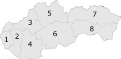
6: Banská Bystrica Region

Prihradzany | |
|---|---|
Municipality | |
 Lutheran Church in Prihradzany | |
 Prihradzany Location of Prihradzany in the
Banská Bystrica Region  Prihradzany Location of Prihradzany in Slovakia | |
| Coordinates: 48°35′00″N 20°14′20″E / 48.58333°N 20.23889°E | |
| Country | |
| Region | Banská Bystrica |
| District | Revúca |
| First mentioned | 1262 |
| Area | |
| • Total | 4.55 km2 (1.76 sq mi) |
| Elevation | 260 m (850 ft) |
| Time zone | UTC+1 ( CET) |
| • Summer ( DST) | UTC+2 ( CEST) |
| Postal code | 049 14 (pošta Licince) |
| Area code | 421-58 |
| Car plate | RA |
| Website |
www |
Prihradzany ( Hungarian: Kisperlász) is a village and municipality in Revúca District in the Banská Bystrica Region of Slovakia. Before the First World War it belonged to Hungary for 1000 years. Its name is Kisperlász in Hungarian

In the cemetery stands the old rotunda named St. Anna. It had been built in the 11th-12th century in the Árpád age. Its diameter is 9 meters.
- Gervers-Molnár V. (1972): A középkori Magyarország rotundái. (Romanesque Round Churches of Medieval Hungary.) (Mûvészettörténeti Füzetek, 4.) Akadémiai, Budapest
-
 Media related to
Prihradzany at Wikimedia Commons
Media related to
Prihradzany at Wikimedia Commons -
Official website

- http://www.statistics.sk/mosmis/eng/run.html
- Information homepage of the village Prihradzany (Kisperlász)
- Prihradzany (Kisperlász) in Slovakia Map
- Prihradzany (Kisperlász) as site for pilgrimage
- Barna Gábor stufies in Journal Néprajzi Látóhatár (in Hungarian).
- Erdélyi G.: Gömör vármegye klasszicista építészete (Classicist architecture in Gömör County).
|
| This Banská Bystrica Region geography article is a stub. You can help Wikipedia by expanding it. |