Photos • Location
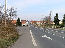
Main street


Postřižín | |
|---|---|
 Chapel in the centre of Postřižín | |
 Flag  Coat of arms | |
 Postřižín Location in the Czech Republic | |
| Coordinates: 50°13′59″N 14°23′12″E / 50.23306°N 14.38667°E | |
| Country | |
| Region | Central Bohemian |
| District | Mělník |
| First mentioned | 1052 |
| Area | |
| • Total | 4.43 km2 (1.71 sq mi) |
| Elevation | 228 m (748 ft) |
| Population (2024-01-01)
[1] | |
| • Total | 1,950 |
| • Density | 440/km2 (1,100/sq mi) |
| Time zone | UTC+1 ( CET) |
| • Summer ( DST) | UTC+2 ( CEST) |
| Postal code | 250 70 |
| Website |
www |
Postřižín is a municipality and village in Mělník District in the Central Bohemian Region of the Czech Republic. It has about 2,000 inhabitants.
Geography
Postřižín is located about 13 kilometres (8 mi) north of Prague. It lies in an agricultural landscape, on the border between the Central Elbe Table and Prague Plateau. The highest point is at 274 m (899 ft) above sea level.
History
The first written mention of Postřižín is in a deed of Duke Bretislav I from 1052. [2]
Demographics
|
|
| ||||||||||||||||||||||||||||||||||||||||||||||||||||||
| Source: Censuses [3] [4] | ||||||||||||||||||||||||||||||||||||||||||||||||||||||||
Transport

The D8 motorway from Prague to Ústí nad Labem passes through the municipality.
Sights
There are no cultural monuments. [5] In the centre of Postřižín is a small chapel.
Notable people
- František Janda-Suk (1878–1955), discus thrower, the first Czech Olympic medalist
References
- ^ "Population of Municipalities – 1 January 2024". Czech Statistical Office. 2024-05-17.
- ^ "Historie obce" (in Czech). Obec Postřižín. Retrieved 2024-02-26.
- ^ "Historický lexikon obcí České republiky 1869–2011 – Okres Mělník" (in Czech). Czech Statistical Office. 2015-12-21. pp. 9–10.
- ^ "Population Census 2021: Population by sex". Public Database. Czech Statistical Office. 2021-03-27.
- ^ "Výsledky vyhledávání: Kulturní památky, okres Mělník". Ústřední seznam kulturních památek (in Czech). National Heritage Institute. Retrieved 2023-04-01.
External links
Wikimedia Commons has media related to
Postřižín.
| Authority control databases: National |
|---|