Photos • Location
Poolapatti
பூலாபட்டி Poolampatti | |
|---|---|
Hamlet / Village | |
| Poolappatti | |
| Coordinates: 12°02′37″N 78°10′03″E / 12.0437°N 78.1675°E | |
| Country | |
| State | Tamil Nadu |
| Region | Kongu Nadu |
| District | Dharmapuri |
| Thaluk | Nallampalli [1] |
| Block | Nallampalli |
| Panchayat | Mittareddihalli |
| Population (2011) | |
| • Total | 103 |
| Languages | |
| • Official | Tamil |
| • Secondary | Telugu |
| Time zone | UTC+5:30 ( IST) |
| PIN | 636804 |
| Post Office | Laligam
[2] |
| Telephone code | 91-4348 |
| Vehicle registration | TN-29 |
| Lok Sabha Constituency | Dharmapuri |
| Lok Sabha Member | S. Senthilkumar |
| Assembly Constituency | Dharmapuri |
| Assembly Member | S. P. Venkateshwaran |
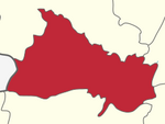
Poolapatti, is a village also officially spelled as Poolappatti, is a village located 6 km east from the major town Nallampalli, Tamil Nadu, India. This village comes under the Mittareddihalli (M.Reddihalli) Gram panchayat. [3]
Culture
Poolappatti holds a unique cultural identity, heavily influenced by the presence of Catholic missionaries who settled in the Kovilur over a century ago. As a result, the village has a notable population of Catholics who actively participate in religious rituals and festivities.

