Photos • Location
Poštorná | |
|---|---|
Municipal district | |
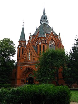
 Church in Poštorná | |
| Coordinates: 48°45′0″N 16°51′48″E / 48.75000°N 16.86333°E | |
| Country | Czech Republic |
| Region | South Moravian |
| District | Břeclav |
| Town | Břeclav |
| Area | |
| • Total | 21.77 km2 (8.41 sq mi) |
| Time zone | UTC+1 ( CET) |
| • Summer ( DST) | UTC+2 ( CEST) |
| Postal code | 691 41 |
Poštorná is a municipal district located in the town of Břeclav, South Moravia, Czech Republic.
Former football club SK Tatran Poštorná was based in the district.
External links
- Poštorná statistics at Ministry of the Interior website (in Czech)
- Databáze statistických obvodů (Statistical database of districts) (in Czech)
