Photos • Location
Pampa Hermosa District | |
|---|---|
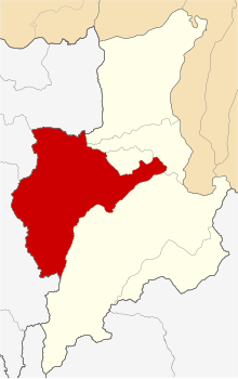
 Location of Pampa Hermosa in the
Ucayali province | |
| Country | |
| Region | Loreto |
| Province | Ucayali |
| Founded | September 15, 1961 |
| Capital | Pampa Hermosa |
| Government | |
| • Mayor | Luis Del Castillo Tananta |
| Area | |
| • Total | 7,346.98 km2 (2,836.68 sq mi) |
| Elevation | 132 m (433 ft) |
| Population (
2005 census) | |
| • Total | 5,067 |
| • Density | 0.69/km2 (1.8/sq mi) |
| Time zone | UTC-5 ( PET) |
| UBIGEO | 160604 |
Pampa Hermosa District is one of six districts of the province Ucayali in Peru. [1]
References
- ^ (in Spanish) Instituto Nacional de Estadística e Informática. Banco de Información Distrital Archived 2008-04-23 at the Wayback Machine. Retrieved April 11, 2008.
7°11′57″S 75°51′38″W / 7.1991°S 75.8605°W