Photos • Location
This article relies largely or entirely on a
single source. (July 2015) |
Palma District
Wilaya ya Palma (
Swahili) | |
|---|---|
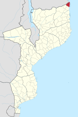
 District location in Mozambique | |
| Country | |
| Province | Cabo Delgado Province |
| Capital | Palma |
| Area | |
| • Total | 3,576 km2 (1,381 sq mi) |
| Population (2015) | |
| • Total | 52,269 |
| • Density | 15/km2 (38/sq mi) |
| Time zone | UTC+2 ( EAT) |
Palma District is a district of Cabo Delgado Province in northern Mozambique. It covers 3,576 km2 with 52,269 inhabitants (2015). Its principal town is Palma. The district borders Mtwara Region, Tanzania to the north.
External links
- Government profile (in Portuguese)