Omega, Georgia | |
|---|---|
 Omega City Hall | |
 Location in
Tift County and the state of
Georgia | |
| Coordinates: 31°20′23″N 83°35′42″W / 31.33972°N 83.59500°W | |
| Country | United States |
| State | Georgia |
| Counties | Tift, Colquitt |
| Area | |
| • Total | 1.80 sq mi (4.67 km2) |
| • Land | 1.78 sq mi (4.62 km2) |
| • Water | 0.02 sq mi (0.06 km2) |
| Elevation | 322 ft (98 m) |
| Population (
2020) | |
| • Total | 1,318 |
| • Density | 739.20/sq mi (285.42/km2) |
| Time zone | UTC-5 ( Eastern (EST)) |
| • Summer ( DST) | UTC-4 (EDT) |
| ZIP code | 31775 |
| Area code | 229 |
| FIPS code | 13-58184 [2] |
| GNIS feature ID | 0332576 [3] |
Omega is a city in Tift and Colquitt counties in the U.S. state of Georgia. The population was 1,318 in 2020.
History
Omega was originally called Surrey, and under the latter name was founded ca. 1889 when the railroad was extended to that point. [4]
Geography
Omega is located at 31°20′23″N 83°35′42″W / 31.33972°N 83.59500°W (31.339684, -83.595036). [5]
According to the United States Census Bureau, the city has a total area of 1.8 square miles (4.7 km2), of which 1.8 square miles (4.7 km2) is land and 0.56% is water.
Demographics
| Census | Pop. | Note | %± |
|---|---|---|---|
| 1910 | 274 | — | |
| 1920 | 329 | 20.1% | |
| 1930 | 324 | −1.5% | |
| 1940 | 608 | 87.7% | |
| 1950 | 966 | 58.9% | |
| 1960 | 940 | −2.7% | |
| 1970 | 835 | −11.2% | |
| 1980 | 996 | 19.3% | |
| 1990 | 912 | −8.4% | |
| 2000 | 1,340 | 46.9% | |
| 2010 | 1,221 | −8.9% | |
| 2020 | 1,318 | 7.9% | |
| U.S. Decennial Census [6] | |||
| Race | Num. | Perc. |
|---|---|---|
| White (non-Hispanic) | 433 | 32.85% |
| Black or African American (non-Hispanic) | 200 | 15.17% |
| Native American | 2 | 0.15% |
| Asian | 7 | 0.53% |
| Other/Mixed | 25 | 1.9% |
| Hispanic or Latino | 651 | 49.39% |
At the 2020 United States census, there were 1,318 people, 440 households, and 326 families residing in the city.
References
- ^ "2020 U.S. Gazetteer Files". United States Census Bureau. Retrieved December 18, 2021.
- ^ "U.S. Census website". United States Census Bureau. Retrieved January 31, 2008.
- ^ "US Board on Geographic Names". United States Geological Survey. October 25, 2007. Retrieved January 31, 2008.
- ^ Krakow, Kenneth K. (1975). Georgia Place-Names: Their History and Origins (PDF). Macon, GA: Winship Press. p. 167. ISBN 0-915430-00-2.
- ^ "US Gazetteer files: 2010, 2000, and 1990". United States Census Bureau. February 12, 2011. Retrieved April 23, 2011.
- ^ "Census of Population and Housing". Census.gov. Retrieved June 4, 2015.
- ^ "Explore Census Data". data.census.gov. Retrieved December 18, 2021.
Municipalities and communities of
Tift County, Georgia, United States | ||
|---|---|---|
| Cities |  | |
| CDPs | ||
|
Unincorporated communities | ||
| Footnotes | ‡This populated place also has portions in an adjacent county or counties | |
Municipalities and communities of
Colquitt County, Georgia, United States | ||
|---|---|---|
| Cities | 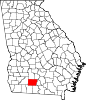 | |
| Towns | ||
|
Unincorporated communities | ||
| Footnotes | ‡This populated place also has portions in an adjacent county or counties | |
| International | |
|---|---|
| National | |