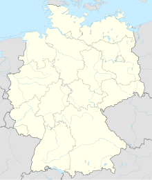
Photos • Location
You can help expand this article with text translated from
the corresponding article in German. (March 2022) Click [show] for important translation instructions.
|
Neubrandenburg Airport Flughafen Neubrandenburg | |||||||||||
|---|---|---|---|---|---|---|---|---|---|---|---|
 | |||||||||||
| Summary | |||||||||||
| Airport type | Public | ||||||||||
| Operator | Flughafen Neubrandenburg–Trollenhagen GmbH | ||||||||||
| Serves | Neubrandenburg, Germany | ||||||||||
| Location | Trollenhagen | ||||||||||
| Built | 1934 | ||||||||||
| Elevation AMSL | 226 ft / 69 m | ||||||||||
| Coordinates | 53°36′7.8″N 13°18′21.6″E / 53.602167°N 13.306000°E | ||||||||||
| Website | flughafen-neubrandenburg.de | ||||||||||
| Map | |||||||||||
| Runways | |||||||||||
| |||||||||||
Neubrandenburg Airport ( IATA: FNB, ICAO: EDBN) is a public, general aviation airport and former military airbase located 6 km (3.7 miles) north-east of Neubrandenburg in Trollenhagen, Mecklenburg-Vorpommern, Germany. [2] [3]
History
From 1949 to 1953 the Soviet 899th Fighter Aviation Regiment was located at the airbase. [4]
See also
References
- ^ "AIP VFR online". dfs.de. DFS Deutsche Flugsicherung GmbH. Retrieved 2023-02-21.
- ^ "Flughafen Neubrandenburg". www.airports.de. Retrieved 19 April 2010.
- ^ "Medientag beim FORCEVAL 2009 auf dem Fliegerhorst Trollenhagen". Luftwaffe (in German). 16 September 2009. Archived from the original on 1 October 2010. Retrieved 19 April 2010.
- ^ Michael Holm, 899th Orshanskiy Red Banner order of Suvorov Fighter-Bomber Aviation Regiment im. F.E. Dzerzhinskiy, 2015.
External links
![]() Media related to
Neubrandenburg Airport at Wikimedia Commons
Media related to
Neubrandenburg Airport at Wikimedia Commons
- Official website
- Accident history for FNB at Aviation Safety Network
- Current weather for EDBN at NOAA/ NWS
