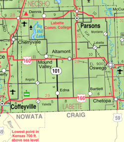
Photos • Location
Montana, Kansas | |
|---|---|
 | |
| Coordinates: 37°16′31″N 95°07′27″W / 37.27528°N 95.12417°W | |
| Country | United States |
| State | Kansas |
| County | Labette |
| Founded | 1868 |
| Platted | 1868 |
| Named for | Montana Territory |
| Time zone | UTC-6 ( CST) |
| • Summer ( DST) | UTC-5 (CDT) |
| Area code | 620 |
Montana is an unincorporated community in Labette County, Kansas, United States.
History
A post office was established at Montana in 1866. [1] Montana was laid out about 1868. [2] The community was named after the Montana Territory. [3]
Education
The community is served by Oswego USD 504 public school district.
References
- ^ "Kansas Post Offices, 1828-1961". Kansas Historical Society. Retrieved June 12, 2014.
- ^ Blackmar, Frank Wilson (1912). Kansas: A Cyclopedia of State History, Volume 2. Standard Publishing Company. pp. 299.
- ^ "Towns named after states". Reading Eagle. July 2, 1897. p. 3. Retrieved October 14, 2015.
Further reading
External links


