Photos • Location
Mełchów | |
|---|---|
Village | |
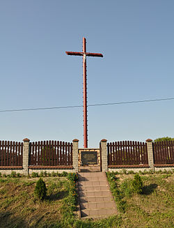
 Mass grave of insurgents fallen in the
Battle of Mełchów in 1863 | |
| Coordinates: 50°43′N 19°35′E / 50.717°N 19.583°E | |
| Country | |
| Voivodeship | Silesian |
| County | Częstochowa |
| Gmina | Lelów |
| Population | 105 |
| Time zone | UTC+1 ( CET) |
| • Summer ( DST) | UTC+2 ( CEST) |
| Vehicle registration | SCZ |
Mełchów [ˈmɛu̯xuf] is a village in the administrative district of Gmina Lelów, within Częstochowa County, Silesian Voivodeship, in southern Poland. [1] It lies approximately 5 kilometres (3 mi) north-west of Lelów, 35 km (22 mi) east of Częstochowa, and 67 km (42 mi) north-east of the regional capital Katowice.
During the January Uprising, on 30 September 1863, the Battle of Mełchów was fought near the village. In the battle, Polish insurgents supported by Hungarian volunteers defeated Russian troops.

