Marum | |
|---|---|
Town and former municipality | |
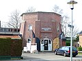
 Marum town hall | |
 Flag  Coat of arms | |
.svg) Location in Groningen | |
 Marum Location in the province of Groningen in the Netherlands  Marum Marum (Netherlands) | |
| Coordinates: 53°9′N 6°16′E / 53.150°N 6.267°E | |
| Country | |
| Province | |
| Municipality |
|
| Merged | 2019 |
| Area | |
| • Total | 43.58 km2 (16.83 sq mi) |
| Elevation | 3 m (10 ft) |
| Population (2021)
[1] | |
| • Total | 8,125 |
| • Density | 190/km2 (480/sq mi) |
| Time zone | UTC+1 ( CET) |
| • Summer ( DST) | UTC+2 ( CEST) |
| Postcode | 9363
[1] |
| Area code | 0594 |
Marum (Dutch pronunciation: [ˈmaːrʏm] ) is a town and a former municipality in the northeastern Netherlands. The municipality was merged into the municipality of Westerkwartier on 1 January 2019. [3]
History
Marum is located in the peat area, and was an agricultural village. [4] It was first mentioned in 1385 and probably means village near the lake. [5] In 1795, it was home to 351 people. [6]
Marum started to industrialise in the early 20th century, [7] the tram from Groningen to Drachten resulted in further growth. [4] The construction of the A7 motorway has resulted in the development of a suburban town. [7] In 2019, it ceased to be an independent municipality and was merged into Westerkwartier. [3]
Former population centres
Boerakker, Jonkersvaart, Lucaswolde, Marum, Niebert, Noordwijk, Nuis, De Wilp.
Notable people
- Tjeerd van Dekken (born 1967), politician [8]
- Aafje Looijenga-Vos (1928–2018), crystallographer [9]
Gallery
-
 Marum, reformed church
 -
 Dutch Topographic map of the municipality of Marum, June 2015
 -
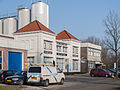 Dairy factory
 -
 Base of a former windmill


References
- ^ a b c "Kerncijfers wijken en buurten 2021". Central Bureau of Statistics. Retrieved 7 March 2022.
- ^ "Postcodetool for 9363BA". Actueel Hoogtebestand Nederland (in Dutch). Het Waterschapshuis. Archived from the original on 21 September 2013. Retrieved 30 January 2014.
- ^ a b "Gemeentelijke indeling op 1 januari 2019". CBS (in Dutch). Retrieved 30 November 2019.
- ^ a b Redmer Alma (1998). Marum (in Dutch). Zwolle: Waanders Uitgevers. p. 159. ISBN 90 400 9258 3. Retrieved 9 March 2022.
- ^ "Marum". Etymologiebank (in Dutch). Retrieved 9 March 2022.
- ^ Verdeling van de provintie van Stad en Lande (in Dutch). Groningen: Oomkens. 1796. p. 36. Retrieved 9 March 2022.
- ^ a b "Marum". Plaatsengids (in Dutch). Retrieved 9 March 2022.
- ^ "Tj.R. (Tjeerd) van Dekken". Dutch Parliament (in Dutch). Retrieved 9 March 2022.
- ^ Bram Schierbeek (2018). "Aafje Looijenga-Vos (1928-2018)". International Union of Crystallography. Retrieved 9 March 2022.
External links
![]() Media related to
Marum at Wikimedia Commons
Media related to
Marum at Wikimedia Commons
Places adjacent to Marum | ||||||||||||||||
|---|---|---|---|---|---|---|---|---|---|---|---|---|---|---|---|---|
| ||||||||||||||||
|
| This Groningen location article is a stub. You can help Wikipedia by expanding it. |