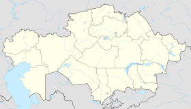
Photos • Location
Mamlyut
| |
|---|---|
| Coordinates: 54°56′15″N 68°32′22″E / 54.93750°N 68.53944°E | |
| Country | Kazakhstan |
| Region | North Kazakhstan Region |
| District | Mamlyut District |
| Government | |
| • Akim ( mayor) | Serik Bakeev |
| Population (2013) | |
| • Total | 7,320 |
| Time zone | UTC+6 ( Asia/Almaty) |
| Website | http://www.maml.sko.kz |
Mamlyut ( Kazakh: Мамлют, Mamliut) is a town (till 1969 — village) that is the administrative center of Mamlyut District, North Kazakhstan Region, Kazakhstan.
There is a railway station on the Kurgan — Petropavl line in the town.
54°56′29″N 68°32′26″E / 54.94139°N 68.54056°E

