Photos • Location
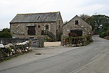
Converted farm buildings at Maders


Maders is a hamlet west of Kelly Bray in the parish of South Hill (where the population of the 2011 census was included) in east Cornwall, England. [1]
References
- ^ Ordnance Survey: Landranger map sheet 201 Plymouth & Launceston (Map). Ordnance Survey. ISBN 978-0-319-23287-3.
| Unitary authorities | |
|---|---|
| Major settlements (cities in italics) |
|
| Rivers | |
| Topics | |
50°31′09″N 4°20′14″W / 50.5191205°N 4.337286°W
|
| This Cornwall location article is a stub. You can help Wikipedia by expanding it. |