Photos • Location

There are at least 28 named lakes and reservoirs in Dawson County, Montana.
Lakes
|
| This section is empty. You can help by
adding to it. (January 2011) |
Reservoirs
- Bailer Reservoir, 46°55′00″N 104°44′19″W / 46.91667°N 104.73861°W, el. 2,205 feet (672 m) [1]
- Big Drop Reservoir, 46°53′40″N 104°38′38″W / 46.89444°N 104.64389°W, el. 2,379 feet (725 m) [2]
- Camp Reservoir, 46°53′38″N 104°38′17″W / 46.89389°N 104.63806°W, el. 2,385 feet (727 m) [3]
- Circle Reservoir, 47°32′18″N 105°13′44″W / 47.53833°N 105.22889°W, el. 2,503 feet (763 m) [4]
- Crisafulli Lake, 47°07′53″N 104°44′42″W / 47.13139°N 104.74500°W, el. 2,159 feet (658 m) [5]
- Deer Creek Reservoir, 47°14′42″N 105°04′38″W / 47.24500°N 105.07722°W, el. 2,717 feet (828 m) [6]
- Forks Reservoir, 46°53′14″N 104°39′28″W / 46.88722°N 104.65778°W, el. 2,326 feet (709 m) [7]
- Gagena Reservoir, 46°53′28″N 104°31′18″W / 46.89111°N 104.52167°W, el. 2,648 feet (807 m) [8]
- Hollecker Lake, 47°07′45″N 104°43′38″W / 47.12917°N 104.72722°W, el. 2,083 feet (635 m) [9]
- Hollecker Reservoir, 47°07′48″N 104°43′38″W / 47.13000°N 104.72722°W, el. 2,083 feet (635 m) [10]
- Jack Downs Reservoir, 47°10′30″N 105°06′38″W / 47.17500°N 105.11056°W, el. 2,641 feet (805 m) [11]
- Johnson Reservoir, 47°18′52″N 105°05′46″W / 47.31444°N 105.09611°W, el. 2,657 feet (810 m) [12]
- Keeland Reservoir, 47°38′42″N 105°01′31″W / 47.64500°N 105.02528°W, el. 2,474 feet (754 m) [13]
- Lindsay Reservoir, 47°13′03″N 105°09′05″W / 47.21750°N 105.15139°W, el. 2,694 feet (821 m) [14]
- Longs Reservoir, 47°38′28″N 105°01′05″W / 47.64111°N 105.01806°W, el. 2,477 feet (755 m) [15]
- Malkuch Reservoir, 47°09′45″N 105°00′47″W / 47.16250°N 105.01306°W, el. 2,513 feet (766 m) [16]
- Malkuch Reservoir, 47°09′54″N 105°18′56″W / 47.16500°N 105.31556°W, el. 2,926 feet (892 m) [17]
- Milliron Reservoir Number 1, 47°10′22″N 104°24′57″W / 47.17278°N 104.41583°W, el. 2,303 feet (702 m) [18]
- Milliron Reservoir Number 2, 47°09′12″N 104°23′58″W / 47.15333°N 104.39944°W, el. 2,306 feet (703 m) [19]
- Prairie Goat Reservoir, 46°53′44″N 104°38′13″W / 46.89556°N 104.63694°W, el. 2,382 feet (726 m) [20]
- Roy Richey Reservoir, 47°38′48″N 105°07′02″W / 47.64667°N 105.11722°W, el. 2,457 feet (749 m) [21]
- Senner Reservoir, 47°31′18″N 104°48′56″W / 47.52167°N 104.81556°W, el. 2,726 feet (831 m) [22]
- Twin Forks Reservoir, 46°53′33″N 104°35′16″W / 46.89250°N 104.58778°W, el. 2,461 feet (750 m) [23]
- Twin Forks Reservoir, 46°53′42″N 104°35′14″W / 46.89500°N 104.58722°W, el. 2,461 feet (750 m) [24]
- Upper Labell Reservoir, 46°53′02″N 104°35′21″W / 46.88389°N 104.58917°W, el. 2,421 feet (738 m) [25]
- Upper Magpie Reservoir, 46°56′48″N 104°39′26″W / 46.94667°N 104.65722°W, el. 2,323 feet (708 m) [26]
- Wold Reservoir, 47°38′00″N 105°00′09″W / 47.63333°N 105.00250°W, el. 2,477 feet (755 m) [27]
- Wolff Reservoir, 47°10′36″N 105°04′32″W / 47.17667°N 105.07556°W, el. 2,595 feet (791 m) [28]
See also
Notes
- ^ "Bailer Reservoir". Geographic Names Information System. United States Geological Survey, United States Department of the Interior.
- ^ "Big Drop Reservoir". Geographic Names Information System. United States Geological Survey, United States Department of the Interior.
- ^ "Camp Reservoir". Geographic Names Information System. United States Geological Survey, United States Department of the Interior.
- ^ "Circle Reservoir". Geographic Names Information System. United States Geological Survey, United States Department of the Interior.
- ^ "Crisafulli Lake". Geographic Names Information System. United States Geological Survey, United States Department of the Interior.
- ^ "Deer Creek Reservoir". Geographic Names Information System. United States Geological Survey, United States Department of the Interior.
- ^ "Forks Reservoir". Geographic Names Information System. United States Geological Survey, United States Department of the Interior.
- ^ "Gagena Reservoir". Geographic Names Information System. United States Geological Survey, United States Department of the Interior.
- ^ "Hollecker Lake". Geographic Names Information System. United States Geological Survey, United States Department of the Interior.
- ^ "Hollecker Reservoir". Geographic Names Information System. United States Geological Survey, United States Department of the Interior.
- ^ "Jack Downs Reservoir". Geographic Names Information System. United States Geological Survey, United States Department of the Interior.
- ^ "Johnson Reservoir". Geographic Names Information System. United States Geological Survey, United States Department of the Interior.
- ^ "Keeland Reservoir". Geographic Names Information System. United States Geological Survey, United States Department of the Interior.
- ^ "Lindsay Reservoir". Geographic Names Information System. United States Geological Survey, United States Department of the Interior.
- ^ "Longs Reservoir". Geographic Names Information System. United States Geological Survey, United States Department of the Interior.
- ^ "Malkuch Reservoir". Geographic Names Information System. United States Geological Survey, United States Department of the Interior.
- ^ "Malkuch Reservoir". Geographic Names Information System. United States Geological Survey, United States Department of the Interior.
- ^ "Milliron Reservoir Number 1". Geographic Names Information System. United States Geological Survey, United States Department of the Interior.
- ^ "Milliron Reservoir Number 2". Geographic Names Information System. United States Geological Survey, United States Department of the Interior.
- ^ "Prairie Goat Reservoir". Geographic Names Information System. United States Geological Survey, United States Department of the Interior.
- ^ "Roy Richey Reservoir". Geographic Names Information System. United States Geological Survey, United States Department of the Interior.
- ^ "Senner Reservoir". Geographic Names Information System. United States Geological Survey, United States Department of the Interior.
- ^ "Twin Forks Reservoir". Geographic Names Information System. United States Geological Survey, United States Department of the Interior.
- ^ "Twin Forks Reservoir". Geographic Names Information System. United States Geological Survey, United States Department of the Interior.
- ^ "Upper Labell Reservoir". Geographic Names Information System. United States Geological Survey, United States Department of the Interior.
- ^ "Upper Magpie Reservoir". Geographic Names Information System. United States Geological Survey, United States Department of the Interior.
- ^ "Wold Reservoir". Geographic Names Information System. United States Geological Survey, United States Department of the Interior.
- ^ "Wolff Reservoir". Geographic Names Information System. United States Geological Survey, United States Department of the Interior.
Municipalities and communities of
Dawson County, Montana, United States | ||
|---|---|---|
| City | 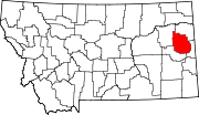 | |
| Town | ||
| CDPs | ||