Photos • Location
(Redirected from
Lepi, Angola)
Lepi | |
|---|---|
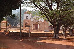
 Reconstruction of a church in Lepi, 2007 | |
| Country | |
| Province | Huambo |
| Area | |
| • Total | 164 sq mi (426 km2) |
| Population (2014)
[1] | |
| • Total | 23,074 |
| • Density | 140/sq mi (54/km2) |
| Time zone | UTC+1 ( WAT) |
| Climate | Aw |
Lepi is a commune of Angola, located in the province of Huambo. [2] [3]
See also
References
- ^ Citypopulation.de Population of provinces and communes in Angola
- ^ "Longonjo". Official Portal of the 2014 INE Angola Census. Retrieved 18 May 2018.
- ^ "Lepi". google maps. Retrieved 18 May 2018.