Photos • Location
You can help expand this article with text translated from
the corresponding article in Japanese. (July 2011) Click [show] for important translation instructions.
|
| Koshibu Dam | |
|---|---|
 | |
| Official name | 小渋ダム |
| Location | Nagano Prefecture, Japan |
| Purpose | Flood control, irrigation, power generation |
| Construction began | 1961 |
| Opening date | 1969 |
| Owner(s) | Chūbu Regional Development Bureau, Ministry of Land, Infrastructure, Transport and Tourism |
| Dam and spillways | |
| Type of dam | Arch dam |
| Impounds | Tenryū River |
| Reservoir | |
| Creates | Koshibu Lake |
| Catchment area | 288 km² (111.2 mi²) |
| Koshibu Number 1 Power Plant Koshibu Number 2 Power Plant Koshibu Number 3 Power Plant | |
| Installed capacity | 9.5
MW 6.5 MW 0.55 MW |
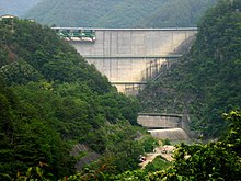
Koshibu Dam ( Japanese: 小渋ダム) is a dam in the Nagano Prefecture, Japan, completed in 1969. [1]
References
35°36′25″N 137°58′44″E / 35.60694°N 137.97889°E