Photos • Location
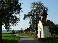
Chapel in Kematen an der Ybbs, Mostviertel, Sonntagberg visible in background.


Kematen an der Ybbs | |
|---|---|
 Aerial view | |
 Coat of arms | |
 Kematen an der Ybbs Location within Austria | |
| Coordinates: 48°2′N 14°46′E / 48.033°N 14.767°E | |
| Country | Austria |
| State | Lower Austria |
| District | Amstetten |
| Government | |
| • Mayor | Juliana Günther ( ÖVP) |
| Area | |
| • Total | 10.99 km2 (4.24 sq mi) |
| Elevation | 330 m (1,080 ft) |
| Population (2018-01-01)
[2] | |
| • Total | 2,625 |
| • Density | 240/km2 (620/sq mi) |
| Time zone | UTC+1 ( CET) |
| • Summer ( DST) | UTC+2 ( CEST) |
| Postal code | 3330 |
| Area code | 07448 |
| Website | www.kematen-ybbs.gv.at |
Kematen an der Ybbs is a town in the district of Amstetten in Lower Austria, Austria.

Geography
Kematen an der Ybbs lies in the Mostviertel in Lower Austria on the Ybbs River. About 22 percent of the municipality is forested.
References
- ^ "Dauersiedlungsraum der Gemeinden Politischen Bezirke und Bundesländer - Gebietsstand 1.1.2018". Statistics Austria. Retrieved 10 March 2019.
- ^ Population at the beginning of the year for municipalities since 2002 (in German), Statistics Austria, January 2023, Wikidata Q27838750
Wikimedia Commons has media related to
Kematen an der Ybbs.
| International | |
|---|---|
| National | |
|
| This Lower Austria location article is a stub. You can help Wikipedia by expanding it. |