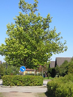
Photos • Location
Kastanjegården | |
|---|---|
Neighbourhood | |
 | |
| Coordinates: 55°33′22″N 13°01′24″E / 55.55611°N 13.02333°E | |
| Country | Sweden |
| Province | Skåne |
| County | Skåne County |
| Municipality | Malmö Municipality |
| Borough of Malmö | Fosie |
| Population (1 January 2011)
[1] | |
| • Total | 720 |
| Time zone | UTC+1 ( CET) |
| • Summer ( DST) | UTC+2 ( CEST) |
Kastanjegården is a neighbourhood of Malmö, situated in the Borough of Fosie, Malmö Municipality, Skåne County, Sweden.
References
- ^ "Befolkning i stadsdelar och delområden" (in Swedish). Malmö stad. Archived from the original on 19 March 2012. Retrieved 10 September 2011.
