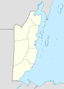
Photos • Location
Johnny Chan Chen Airstrip | |||||||||||
|---|---|---|---|---|---|---|---|---|---|---|---|
| Summary | |||||||||||
| Airport type | Private | ||||||||||
| Serves | Chan Chen, Belize | ||||||||||
| Elevation AMSL | 26 ft / 8 m | ||||||||||
| Coordinates | 18°26′20″N 88°27′05″W / 18.43889°N 88.45139°W | ||||||||||
| Map | |||||||||||
| Runways | |||||||||||
| |||||||||||
Johnny Chan Chen Airstrip ( ICAO: MZJC) is an airport serving Chan Chen, a village in the Corozal District of Belize. The airport is 1.6 kilometres (1 mi) west of Chan Chen and 7 kilometres (4.3 mi) northwest of Corozal.
- ^ Airport information for Johnny Chan Chen Airstrip at Great Circle Mapper.
- ^ "Johnny Chan Chen Airstrip". SkyVector. Retrieved 18 January 2019.
- Aerodromes in Belize - pdf
