Photos • Location
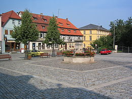
Market square with fountain

Hofheim in Unterfranken | |
|---|---|
 Aerial panorama of Hofheim | |
_COA.svg) Coat of arms | |
Location of Hofheim in Unterfranken within Haßberge district  | |
 Hofheim in Unterfranken  Hofheim in Unterfranken | |
| Coordinates: 50°8′N 10°11′E / 50.133°N 10.183°E | |
| Country | Germany |
| State | Bavaria |
| Admin. region | Unterfranken |
| District | Haßberge |
| Government | |
| • Mayor (2022–28) | Alexander Bergmann [1] ( CSU) |
| Area | |
| • Total | 56.35 km2 (21.76 sq mi) |
| Elevation | 250 m (820 ft) |
| Population (2022-12-31)
[2] | |
| • Total | 5,116 |
| • Density | 91/km2 (240/sq mi) |
| Time zone | UTC+01:00 ( CET) |
| • Summer ( DST) | UTC+02:00 ( CEST) |
| Postal codes | 97461 |
| Dialling codes | 09523 |
| Vehicle registration | HAS |
| Website | www.stadt-hofheim.de |

Hofheim in Unterfranken German pronunciation: [ˈhoːfˌhaɪ̯m] ) is a city located in the district of Haßberge, Unterfranken, Bavaria in Germany.
The municipality consists of the town of Hofheim and the villages of Eichelsdorf, Erlsdorf, Goßmannsdorf, Lendershausen, Manau, Ostheim, Reckertshausen, Rügheim and Sulzbach.
Between 1892 and 1995 it also had a branch line to Haßfurt.
Major trades are farming, gardening, fruit-growing, and small industry like metal- and textile-processing and brewing.
References
- ^ Liste der ersten Bürgermeister/Oberbürgermeister in kreisangehörigen Gemeinden, Bayerisches Landesamt für Statistik. Retrieved 5 September 2023.
- ^ Genesis Online-Datenbank des Bayerischen Landesamtes für Statistik Tabelle 12411-003r Fortschreibung des Bevölkerungsstandes: Gemeinden, Stichtag (Einwohnerzahlen auf Grundlage des Zensus 2011) ( Hilfe dazu).
Towns and municipalities in
Haßberge (district) | ||
|---|---|---|
 | ||
| International | |
|---|---|
| National | |
| Geographic | |
|
| This Haßberge location article is a stub. You can help Wikipedia by expanding it. |