Photos • Location


Hlavňovice | |
|---|---|
 Centre of Hlavňovice | |
 Hlavňovice Location in the Czech Republic | |
| Coordinates: 49°14′17″N 13°23′42″E / 49.23806°N 13.39500°E | |
| Country | |
| Region | Plzeň |
| District | Klatovy |
| First mentioned | 1428 |
| Area | |
| • Total | 24.10 km2 (9.31 sq mi) |
| Elevation | 687 m (2,254 ft) |
| Population (2023-01-01)
[1] | |
| • Total | 500 |
| • Density | 21/km2 (54/sq mi) |
| Time zone | UTC+1 ( CET) |
| • Summer ( DST) | UTC+2 ( CEST) |
| Postal codes | 341 42, 342 01 |
| Website |
www |
Hlavňovice is a municipality and village in Klatovy District in the Plzeň Region of the Czech Republic. It has about 500 inhabitants.
Hlavňovice lies approximately 20 kilometres (12 mi) south-east of Klatovy, 58 km (36 mi) south of Plzeň, and 121 km (75 mi) south-west of Prague.
Administrative parts
The villages and hamlets of Častonice, Čeletice, Cihelna, Horní Staňkov, Javoříčko, Libětice, Milínov, Pích, Přestanice, Puchverk, Radostice, Suchá, Zámyšl and Zvíkov are administrative parts of Hlavňovice.
Demographics
| Year | Pop. | ±% |
|---|---|---|
| 1869 | 1,543 | — |
| 1880 | 1,478 | −4.2% |
| 1890 | 1,326 | −10.3% |
| 1900 | 1,325 | −0.1% |
| 1910 | 1,249 | −5.7% |
| 1921 | 1,207 | −3.4% |
| 1930 | 1,178 | −2.4% |
| 1950 | 757 | −35.7% |
| 1961 | 764 | +0.9% |
| 1970 | 675 | −11.6% |
| 1980 | 576 | −14.7% |
| 1991 | 542 | −5.9% |
| 2001 | 502 | −7.4% |
| 2011 | 469 | −6.6% |
| 2021 | 491 | +4.7% |
| Source: Censuses [2] [3] | ||
Gallery
-
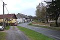 Road
Road -
 Church of Saint John of Nepomuk


References
- ^ "Population of Municipalities – 1 January 2023". Czech Statistical Office. 2023-05-23.
- ^ "Historický lexikon obcí České republiky 1869–2011 – Okres Klatovy" (in Czech). Czech Statistical Office. 2015-12-21. pp. 7–8.
- ^ "Population Census 2021: Population by sex". Public Database. Czech Statistical Office. 2021-03-27.
External links
Wikimedia Commons has media related to
Hlavňovice.
| Authority control databases: National |
|---|
|
| This Plzeň Region location article is a stub. You can help Wikipedia by expanding it. |