Gytsjerk
Giekerk | |
|---|---|
Village | |
 St Martin's Church | |
 Coat of arms | |
 Location of the village in Tytsjerksteradiel | |
 Gytsjerk Location in the Netherlands  Gytsjerk Gytsjerk (Netherlands) | |
| Coordinates: 53°14′27″N 5°53′35″E / 53.24083°N 5.89306°E | |
| Country |
|
| Province |
|
| Municipality |
|
| Area | |
| • Total | 5.74 km2 (2.22 sq mi) |
| Elevation | 0.6 m (2.0 ft) |
| Population (2021)
[1] | |
| • Total | 2,275 |
| • Density | 400/km2 (1,000/sq mi) |
| Postal code | 9061
[1] |
| Dialing code | 058 |
Gytsjerk ( Dutch: Giekerk [3]) is a village in Tytsjerksteradiel in the province of Friesland, the Netherlands. It had a population of around 2,300 in 2018. [4]
History
The village was first mentioned in 1439 as Gheszerka, and means "church of Gye (person)". [5] Gytsjerk developed in the middle ages on a sandy ridge. Later, a linear settlement appeared further westwards along the Leeuwarden to Dokkum. The Protestant church was built at the end of the 12th century and was enlarged in the early-16th century. [6] The tower dates from the early-19th century. [7]
Gytsjerk was home to 336 people in 1840. [8] The cooperative dairy factory Trynwâlden was constructed in 1896. It was enlarged and renovated in 1921 and a laboratory was added. [6] From the 1960s onwards, it started to become a suburb of Leeuwarden. [7] Between 2016 and 2017, the shopping mall was demolished and replaced by a new shopping mall. [8]
Notable buildings
Gallery
-
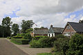 Street in Gytsjerk
 -
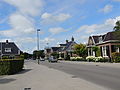 Street view
 -
 Former rye bread factory
 -
 Greengrocer


References
- ^ a b c "Kerncijfers wijken en buurten 2021". Central Bureau of Statistics. Retrieved 5 April 2022.
- ^ "Postcodetool for 9061AA". Actueel Hoogtebestand Nederland (in Dutch). Het Waterschapshuis. Retrieved 5 April 2022.
- ^ Taalunie (2019). "Friese namen" (in Dutch). Retrieved 18 November 2019.
- ^ [1]-Centraal Bureau voor de Statistieken
-
^
"Gytsjerk - (geografische naam)". Etymologiebank (in Dutch). Retrieved 5 April 2022.
Authenticity of the 1242 reference is in doubt
- ^ a b Ronald Stenvert & Sabine Broekhoven (2000). "Gytsjerk" (in Dutch). Zwolle: Waanders. ISBN 90 400 9476 4. Retrieved 5 April 2022.
- ^ a b "Gytsjerk". Friesland Wonderland (in Dutch). Retrieved 5 April 2022.
- ^ a b "Gytsjerk". Plaatsengids (in Dutch). Retrieved 5 April 2022.
| Administrative Centre |  | |
|---|---|---|
| Villages |
| |
| Hamlets | ||
| Landmarks | ||
| Lakes | ||
|
| This Friesland location article is a stub. You can help Wikipedia by expanding it. |