Photos • Location
| Gorihorn | |
|---|---|
| Isentällispitz | |
 | |
| Highest point | |
| Elevation | 2,986 m (9,797 ft) |
| Prominence | 263 m (863 ft) [1] |
| Parent peak | Flüela Wisshorn |
| Coordinates | 46°47′43″N 9°57′32″E / 46.79528°N 9.95889°E |
| Geography | |
| Location | Graubünden, Switzerland |
| Parent range | Silvretta Alps |
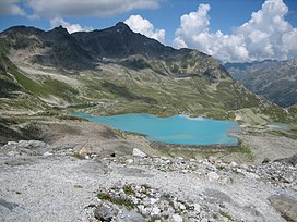
The Gorihorn (also known as Isentällispitz) is a mountain of the Silvretta Alps, located north of the Flüela Pass in the Swiss canton of Graubünden.
References
External links
